Tuesday, May 12, 2015

The National Park Tour Continues

Location: Zion National Park

Waking up to the sound of the creek at Great Basin was heaven. I can't remember the last time I slept for 10 straight hours. I think traveling in Winnie agrees with me. It was a cool morning, but not freezing like last year when we camped here. Last year's Lehman Cave tour was enough and we didn't feel like spending the time doing it again. We thought about driving to the top of Wheeler Point, but the visibility wasn't that terrific so option 3 won out. Keep on trucking to Zion.

I expected the drive from Great Basin to Zion to be incredibly bleak. On the map all you see is one great big blank white spot. We were delightfully surprised with the gorgeous scenery. Even though it was incredibly remote, as evidenced by the half-eaten cow on the side of the road, it wasn't arid. We drove through marshland with lots of fowl, and driving over the pass between the Wah-Wah Mountains and the San Francisco Mountain range was really beautiful.


It had been many years since our last visit to Zion. It's one of our favorite National Parks and even though this was our 4th trip here, it never ceases to take our breath away. Ned made a great observation. He said that visiting the Grand Canyon was looking down over the rim while at Zion you are at the bottom of the canyon looking up. Exactly. As the light changes through-out the day the same spectacular views continue to change as well.

After a quick lunch at the campsite, (for the record those were Virgin Bloody Mary's we were drinking...which seemed appropriate as we are camped on the banks of the Virgin River), we rode our bikes to the inter-park shuttle and headed for the Emerald Pool Trailhead.


In this case, the hike was all about the journey and not the destination. It was challenging to navigate the many sandy steps and boulders, especially with the amount of people on the trail. On the way from the Emerald Pools we decided to veer off from the crowd and take the lesser used Kayenta Trail. The rock formations and views of the valley were amazing!


The lower, middle and upper pools were understated. First, they were barely pools, more like stagnant water, and not sure where the "Emerald" factored in. However, the hike itself was spectacular.


The breathtaking scenery, the flowering cactus, the myriad of multi-colored wildflowers and the interesting rock formations made the hike worthwhile. We felt like we were at the United Nations while hiking. The languages we heard were German, French, Italian, Russian, Chinese, Japanese and a few others I couldn't identify. This National Park is definitely on the world tour.


We're loving our campsite. Yes, six months ago to the day I stayed up all night waiting to hit the button to reserve a site. By the time I completed the transaction there were no campsites left. Crazy, but oh so worth it!


Some of our favorite pics of the day...


The Greatest Hits Tour begins!

Location: Great Basin National Park

And we're off! We officially hit the road at 7:15. This is our 7th year of traveling with Winnie and we decided that for the first half of the trip we would revisit some of our favorite places, thus naming our trip this year "The Greatest Hits Tour." The second half of the trip is going to be recreating the Russell Family 1929 Trek on the Lincoln Highway. On this first leg of the journey it will be interesting to see if each place is as great as we remember or will be a "Billy Jack Moment." Let me explain. When I was in 8th Grade I saw Billy Jack. I thought it was the coolest, badass movie ever made. I only saw it that one time, but I could sing the entire theme song (seriously Megan & Josh - not just a one-liner) and would always list it as one of my top 10 favorite movies. Ned had never seen it and after some time (40+ years?!) we watched it on Netflix. Sigh - let's just say it wasn't the masterpiece I remember. (Billy wasn't THAT cute or THAT clever or THAT noble). Now anything that disappoints after high expectations we call it the "Billy Jack Moment." So, this trip is either the Greatest Hits ala The Eagles Reuniting or Billy Jack. Here's to "it's a girl, my Lord, in a flatbed Ford slowing down to take a look at me..."

We traveled highway 50, which is known as the "Loneliest Road in America". Some interesting background on how this road was named. Around 1986 Life Magazine ran a very negative article about Nevada State Highway 50 and titled it "The Loneliest Road." They described this route as "totally empty. There are no points of interest. We don't recommend it. We warn all motorists not to drive there unless they're confident of their survival skills." Oy vey...gauntlet thrown. The Nevada tourism officials were quick to capitalize on this and to combat the negativity they developed a "Loneliest Road in America Official Highway 50 Survival Guide." Brilliant. We bit.

Travelers can pick up a free Loneliest Road Passport at various places along the road. The kit contains a state road map, the Loneliest Road Survival Guidebook showing some things to see and a line map of the road. Travelers stop in the towns of Fernley, Fallon, Austin, Eureka and Ely to get the Loneliest Road Passport stamped. When all the towns are stamped a completed form is mailed (postage free!) to the Nevada Commission on Tourism. You then receive a Loneliest Road survival certificate signed by the Governor (be still my heart), a Loneliest Road lapel pin (oh goody we each get our own - now all we need is a lapel) and a Loneliest Road bumper sticker announcing that you survied this "uninteresting and empty" road. Ha! So, here's some pics of our official 5 stops in these exciting towns!

Our first stop was Fernley. We pulled up to a rather sad looking building that housed the Chamber of Commerce. Our spirits were dashed when we saw that it didn't open til 10 am. Fortunately, the WigWam Casino was across the street and they were also distributing the Passport Guides. We found it rather amusing that the woman who issued us our passport had never looked inside the book. The Loneliest Road indeed!


The next town up was Fallon. We braved the big box stores, fast food restaurants, casinos and dollar stores between the two cities. Yes, dangerous road without a doubt. The Chamber of Commerce was opened in this town and we were greeted by a very friendly young woman. The distillery she was telling us about sounded tasty and almost made me want to veer off course and head down 95. Alas, we continued to venture on down the Loneliest Road.

The stretch of road between Fallon and Austin is remote, but not really too bleak. We traveled up and down mountain passes, following along the Pony Express Trail. The snowcapped mountains were a nice surprise. What we really appreciated was the 72 deg temperature and not summer 120 deg. "egg frying" heat.


Austin was a hard scrapple mining town clinging to the side of the hill and definitely the oldest looking town on Highway 50.

The area between Austin and Eureka reminded us of parts of Northern New Mexico, with lots of mountains and pinion (I think) trees. Eureka is a mid-century town that has seen better days with lots of boarded up or burnt out buildings. We got our books stamped and kept on truckin'.


We continued over several more passes before rolling into Ely where we stopped by the famous Economy Drug Store. Yes, it's a pharmacy, but also known for it's old-fashioned soda fountain specializing in Lime Rickys. Ned ordered a chocolate malt, and as luck would have it, the shake was so big that a second glass was poured. Yum!


Ely has lots of motels, circa 1950, and interesting murals on many of the buildings. It seemed to be the biggest and most touristy of the towns.


We finally arrived at Great Basin National Park and headed for the Visitor Center. As we pulled into the parking lot, Ned says, "Hey, there's that guy from Germany that we were camped next to last year on Cape Breton in Nova Scotia!" We remembered him so well because he had a very unique rig. His plan was to store his camper in the U.S. and every year for the next five years fly to North America and tour. What a coincidence! We ended up camping at the same campground too. (You can see the nose of his rig in the side of this pic).


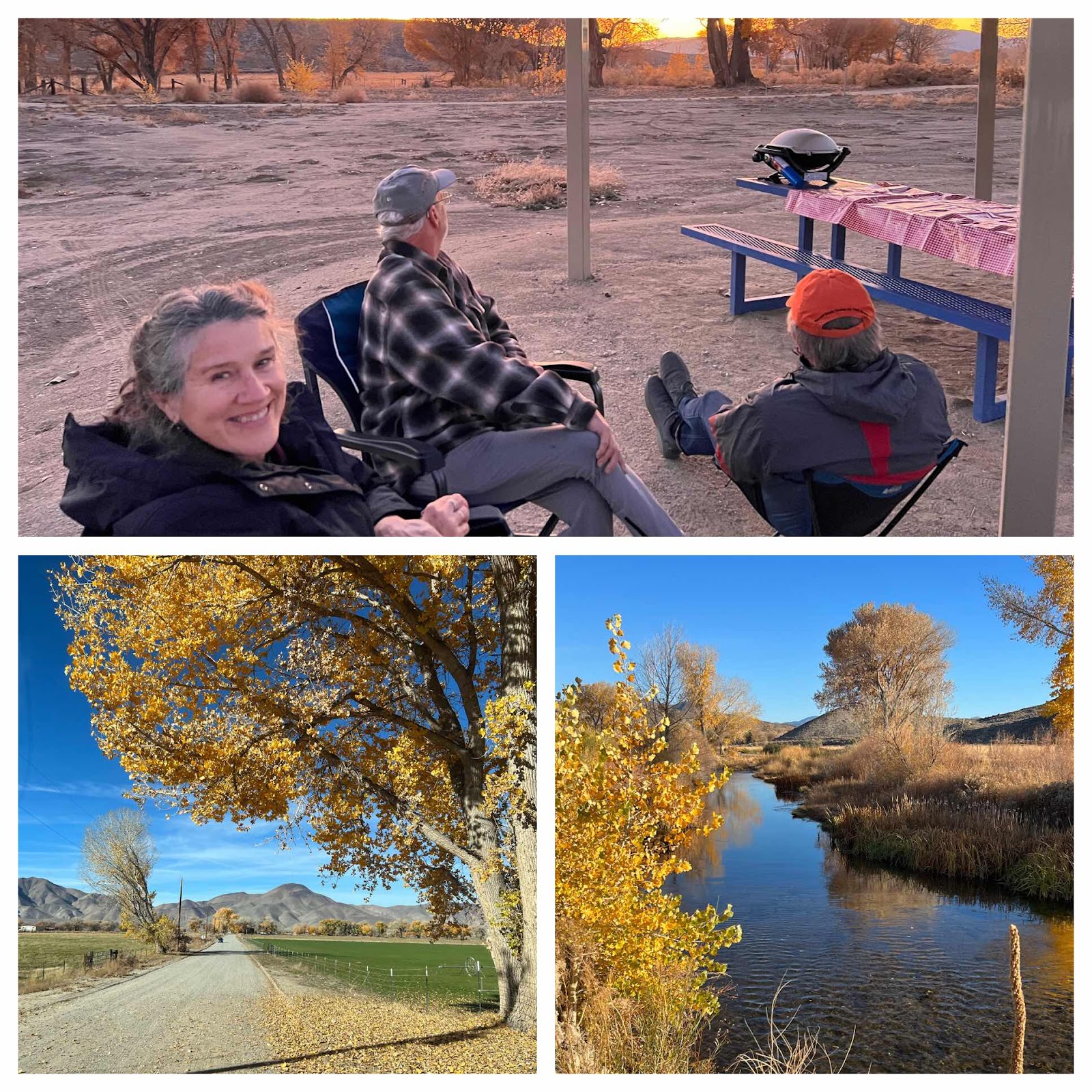
We're camped at Upper Lehman Campground and were able to procure one of our favorite sites right next to the creek. I got in a quick 30 minute run (which was quite a challenge at 7500 ft and hilly) and am now happy as can be with my glass of wine sitting next to our roasted veggies on the grill. Day one and life is very good!


Okay...I just had to throw in one more pic. This one is for my big bro, Mr. G! Spotted this little gem in Ely. Love ya.

Disclaimer - I'm using a new blogging app this year so bear with me as I work out the kinks.


Sunday, June 29, 2014

The Eastern Seaboard Trip - HIghs & Lows

Home Sweet Home
We called this trip the Eastern Seaboard and it really was a treat to drive up a large portion of the East Coast from the Southern tip of New Jersey to the Northern tip of Nova Scotia. We loved the history, people, culture, fishing villages and, of course, the food!

Total Mileage: 11,212
Total Miles Biked: 262
Days on the Road: 50
States Visited: 26
Provinces Visited: 5
Best Meal: Ned - halibut on PEI; Debi - crab cakes in Delaware
Best Bike Ride: Ned - Acadia; Debi - Nickerson Trail, Cape Cod
Best Campground: Cave Mountain Lakes National Forest, VA
Best Surprise Ned: - Jersey Shore -Wildwood cool retro hotels
Best Surprise Debi: - Wichita Mountain Wildlife Refuge
Best Factory Tour: Videri Chocolate, NC
Best Drive: Ile d'Orleans, Quebec
Best Waterfall: Stone Mountain, NC
Most Picturesque Place: Peggy's Cove, Nova Scotia tied with Quebec City
Best Rescuer: Colton, VW Dealer Saco, ME
Best Tourist Attraction: Upper Canada Village
Best Live Music: Pickers at Blue Ridge Music Museum

Worst Meal: Debi Poutine in Charlottetown, PEI; Ned - Rappie Pie in Nova Scotia
Worst Bike Ride: Willard's Bay, Utah
Worst Campground: Cape Henlopen State Park, DE
Worst Tourist Attraction: Natural Bridge, VA
Biggest Disappointment: Shenandoah National Park, VA
Creepiest National Park: Hot Springs, AR
Worst Traffic: Montreal
Most Expensive Cornbeef Sandwich (includes ticket): Montreal
Most Confusing Bridge Tolls: Nova Scotia

Saturday, June 28, 2014

Plum Tired Out

Willard Bay State Park, Utah

We spent the morning crossing back and forth between Wyoming and Utah on a really gorgeous road. It followed a river named Henry's Fork and was one of the most bizarre mix of topographies in such a relatively short distance that we've seen. One side of the road was lush with pasture land, big swatches of purple fields and tree lined meandering creek. The other side of the road was parched desert hills with sage or pinion trees dotted here and there. Then it all suddenly changed to badlands that looked like a futuristic science movie. All within about 40 miles. Dang, our country has some pretty unique environments!

We finally crossed into Utah for good and headed for Ogden. We did a little exploring around town, had lunch at Union Station and were going to visit some museums (free today), but the weather was so gorgeous we couldn't bring ourselves to be stuck inside. Instead we headed for our campground planning on spending some time enjoying a little R&R.

A couple of nights ago we realized that we'd be pulling into a populous area on a Saturday night in the dog days of summer so we pulled the trigger and booked a campsite on line. The good news is that we're glad we did cause the camp ground is sold out. The bad news is that we picked a site in the wrong campground. It's the marina campground and is pretty much a parking lot. Fortunately we have the one campsite in the shade and if we face our chairs with the backs to the road, all we can see is dried prairie. Denial is a wonderful thing.

Several years ago when we camped here (in the north campground) we had a great time biking. We decided to see if we could bike to this campground. These two campgrounds are several exits away on the freeway, have a marina and pasture separating them, but we were confident we could find a trail. Looking at the satellite view of the area it looked like a trail was on the levy surrounding the lake. Off we went. Yes, we encountered the marina - no problema we'll bike around. Gate, no problema we'll skirt around - thru high dried out prairie. Hey, we made it to a dirt road. That road ends, no problema we'll just go through this cornfield. The other option was going through the active skeet shooting range, but we're not THAT stupid. The cornfield ended at a feedlot. We tried going around, but the cows were running around like crazy thinking that they were going to get fed. At this point, we decided okay, let's go back and try perhaps the road.

That was when Ned realized he had a flat. Yes, we had a pump, we had a spare tire, but didn't have the bike tool tire pry bar thingy. Ned, being the gentlemen he is, offered to take my bike and ride back to the van. Heck no, and leave me out in this field with a bunch of stampeding hungry cows? I valiantly (ahem) offered to ride back and get it. By the time I reached the van and got back, Ned had managed to find a shady spot under a tree and had already replaced his leaky tire with the new one. (Maybe I wasn't exactly the Pony Express). Just as we were ready to take off, he looked down and said, "Deb, my front tire is flat!!" Apparently, we had picked up quite a lot of thorns riding through the prairie and cornfields. Ned pulled the tire, did a little "Ned mojo" on it, slung the bad tire over over his shoulder and across his chest like a bandolier and shouted, "Poncho Villa rides again!" Ned always cracks me up.

Ned was marveling at the fact that I didn't pick up any thorns, especially since I had ridden through this mess twice. We hadn't ridden more than two feet when I looked down and I had a flat too. Unbelievable! Thank goodness we each carry spare tubes and a patch kit. So far on this trip, between Winnie and our bikes, we've blown 5 tires! Unfortunately I didn't bring my camera so there are no photos to document any of this excursion.

By the time we made it back to the campsite we were pretty tuckered out. It was a short, but brutal 10 miles. A beer was definitely in order. Because we are in Utah we're honoring the occasion with a "Polygamy Porter." Got to love the description. "Why have just one? Polygamy Porter is a smooth, chocolatey, easy-drinkin' brown porter that's more than a little naughty. Take some home to the wives!"

Our bikes are shot, our bodies are tired, we've got a bag full of dirty laundry, the can of bug spray just ran out, and the Yuba River is calling. The only thing between us and home are 10 hours and the bleakness of Nevada. We've survived 2 months on the road, had the time of our lives, great stories to tell and memories of a lifetime. We can do this.

Friday, June 27, 2014

Chillin' on the Border

Flaming Gorge, - Wy & Utah

Waking up to this morning's view was a real treat. Last night's rainstorm was over and what was left were puffy clouds, calm waters and warm weather. As I mentioned in yesterday's blog, several of the overland trails (Mormon, California, Pioneer & Oregon) all passed through this way. Close by are what still remains as evidence, wagon trail tracks etched into the sandstone, located at the historic site aptly named Oregon Ruts and Register Cliffs. Taking the short hike up the trail we encountered deep gouges into the sandstone. These deep ruts result from years of wagon wear and from intentional cutting by emigrants attempting to ease the steep passage up from the level river bottom to the High Plains. I took some goofy pictures of Ned standing in them (for perspective) and showing they were indeed about arm's width. (Ned is ALWAYS such a good sport!)

Driving from Eastern Wyoming to Western Wyoming there aren't many options for taking the backroads. We found an alternate route through a pass at 7000 ft. until finally ending up at Rawlings. This stretch of land was stunningly beautiful with the colors of the prairie grass, wild flowers and cool rock formations. At one point we came across a little town, barely hanging on, called Medicine Bow. In it's heyday it was a main stop on the Old Lincoln Highway. Today we saw just a few building with names such as "The Lincoln Highway Garage" and "Miss Molly's Washhouse" which does indeed look like it still takes in laundry. The town's other claim to fame is the book, "The Virginians" by Owen Wister. It describes the life of a cowboy on a cattle ranch in Wyoming, just outside of Medicine Bow. We were hoping to visit the small museum, but it was closed.

There are not a lot of options to camp along this stretch of Highway 80 and we decided to drop down to Flaming Gorge. It's about 30 minutes south of Green River, Wyoming. With a name like "Flaming Gorge", we had somewhat high expectations. As we drove for the next 30 miles along parched desert we reset those expectations. The most interesting thing about this campground is that the peninsula juts out into the river just far enough to technically be in Utah. As we entered the campground we were still in Wyoming and it wasn't until we turned into this particular campground that we entered Utah. Weird. It was damn cold and somewhat rainy. We secured a site right along the river, but don't get your hopes up for any breathtaking pictures. The only thing I can say is that it's pretty in a bleak sort of way.

The weather finally cleared up enough for us to take a bike ride, but the winds were blowing over 30 mph. Let's just say it was a short ride. Tomorrow we drive a mile back into Wyoming and then head for Salt Lake City. Yes, we'll really be in Utah. We can feel the pull of Nevada City calling to us. I understand it's going to be in the 90's this weekend in Nevada City. Dang, after all the Nova Scotia and cool Canadian weather we've experienced I hope we don't perish.


Thursday, June 26, 2014

Tourists, Pioneers & Adventurers

Guernsey State Park, WY

Continuing our drive up the Sand Hill Scenic Highway in the early morning light was beautiful. The subtle breeze swayed the tall prairie grasses and flowers and we were rewarded with greens and yellows of every hue. Our only company was the coal trains that relentlessly rolled on.

We eventually made it into the far western side of Nebraska and pulled into the town of Alliance. (Which we now appreciate all the more since we know it's the birthplace of Janet Lamb - of Lamb's Victorian Inn in Grass Valley!). What makes Alliance so special, beside the just mentioned fact, is wonderful kitschy tourist attractions. First stop was Carhenge. It is a replica of England's Stonehenge and was dedicated on the summer solstice in 1987. As far as roadside attractions go, it really doesn't get better than this. Several vintage cars ('46 Willy's Jeep Truck, '57 Plymouth, '71 Vega - just like Ned's dad owned, '62 Valiant, '70 Gremlin - just for you Cary, and a '59 Cadillac to name a few) all gloriously stacked one on top of the other. It was truly a hoot. Of course we had to pick up a shot glass and t-shirt to commemorate the occasion.

Also in Alliance is Dobby's Frontier Town. This little gem is located in the backyard of "Dobby" Lee. His hobby was collecting buildings and artifacts that would have been destroyed or discarded. It isn't particularly neat and tidy (ahem), but what it lacks in charm it makes up in complete weirdness. It's totally free, you can go into each building and pick-up and touch whatever you want. Dobby says he trusts you to leave things in tact. How can you not love that? As we were wandering through this little "Frontier Land", looking at the Saloon, Post Office, Bank, Old Soda Shop, Hamburger Stand, Gas Station and various stuff strewn all about, we wandered into the General Store. The owner's daughter (I think) was meeting with a gentlemen attired in a bee-keepers hat. I overheard the following conversation, "So, we know there are bees in this wall from the window to the corner of the building. Forty years ago when we got this building from Colorado, it had the bees in it. We didn't want to destroy the bees so as we drove the building here, we kept stopping every few miles to allow the bees to catch up." What?! We had so many questions! And why do you want the bees to be moved now? We asked the gentlemen if he planned on taking the bees. His response, "I guess, at least half of them. Don't know if I need that many." While in the General Store I decided to finish that checker game that I started yesterday. For the record, dad, all that thinking paid off. I won:)

After that little tourist excursion, we were onto Wyoming to learn all about the Overland Trails and see the mighty Scott's Bluff. (Hat tip to my big bro who suggested we stop off here.) The irony did not go unnoticed by us that we were using google map to find it when the pioneers used this mighty bluff to actually GUIDE them on their journeys. Many years ago Ned and I drove the original Route 66. For the record, driving highway 2 in this part of the country is MUCH better for authentic businesses of that era. We were loving the ice cream stand, gas station and bakery we spotted, to just name a few.

Scott's Bluff National Monument is impressive for it's geology, a massive bluff towering 800 feet over the valley floor, and for it's role in the Western Expansion. Many of the overland trails passed through this route - the Mormon Trail, Oregon Trail, California Trail and Pony Express. After taking in a film at the Visitor's Center we decided to take a bike ride, suggested by the park ranger, thru the tall prairie grasses. It was unbelievable and really gave you a feeling of what the pioneers experienced. It was blazing hot, close to 100, and I have to admit that our hour bike ride was a bit much for me.

Continuing our education of the Western expansion, we decided to check out Fort Laramie as well. By the time we arrived there, the weather had changed dramatically from brutal heat beating down on us to a huge storm beginning to brew. Fort Laramie is amazing! The history, the huge expanse, the buildings old and new, truly an interesting place. Again, our first stop was the visitor's center and taking in a movie. During the movie they referenced an iron bridge that we had spotted on our drive in. We had assumed it was part of a bike trail. What we learned was that it was built in 1875 as part of the Calvary's plan to attack the Indians. Pretty impressive to see this bridge still standing today. Our initial plan was to ride our bikes through-out the grounds and check-out all the buildings and the bridge. However, the foreboding skies caused us to hesitate. We spent some time just taking in the black, grey, green and blue skies. We had an amazing viewpoint over a huge vista and watched rain, lightening and streaks of sun pierce the landscape. No sooner had we made it into the car then the heavens opened up and boy did the rain fall. Good thing we held off on that bike ride!

Our campsite tonight is one of the more unique places we have ever camped. It's on a damed part of the Platte River. Driving over the dam and seeing the river rage through a very small gorge gave us goosebumps. We are camped high on a bluff overlooking the river. It's very primitive (no flush toilets, no really designated areas) and we had the place to ourselves for quite awhile. After all the reading about the pioneers, Indians, Calvary, etc. we felt like one of the early settlers making our way on the Pioneer Trail. Just us - the dramatic bluffs, river and ominous skies. That is, until a few minutes ago, when several families, complete with 6 kids and 2 boats decided to share our spot. Oh well, I'll keep living the fantasy. We still have 3 more days of our vacation.

Eastern Sierras with Leila and Mike

Walker Ranch Recreation Area & Benton Hot Springs, We spent the last 4 days going off grid and exploring some unique areas around the hi...