 Several people have asked me for a map of our route. As luck would have it, I mapped out our trip, including mileage, as we went along. (Why oh why does this not surprise anyone?). So, above is the actual Oregon route. I also have the map of our California route too in case anyone wants that too...So, to recap, here are the stats:
Total mileage: 2462
Camp grounds:
Mount Lassen 7/6 & 7/7 147 miles
Tingley Lake Estates - Klamath Falls 7/8 mileage: 458 (311/day)
Harris Beach State Park , South Coast 7/9 mileage: 671 (213/day)
Sunset Bay State Park, South Coast 7/10 mileage: 821 (150/day)
Beverly Beach State Park, Central Coast 7/11 mileage: 992 (171/day)
Fort Stevens State Park, North Coast - 7/12 mileage: 1123 (131/day)
Viento State Park - Columbia Gorge - 7/13 mileage: 1356 (233/day)
Toll Bridge CP - Hood River Valley - 7/14 mileage: 1509 (153/day)
Silver Falls SP - Willamette Valley - 7/15 mileage: 1632 (123/day)
Horseshoe Bend FS, N. Umpqua River - 7/16 mileage: 1866 (234/day)
Emigrant Reservoir RV Park, Ashland - 7/17 mileage: 2055 (199/day)
Butte Creek Forest Service - 7/18 (aborted) mileage: 2462 (407/day)
Several people have asked me for a map of our route. As luck would have it, I mapped out our trip, including mileage, as we went along. (Why oh why does this not surprise anyone?). So, above is the actual Oregon route. I also have the map of our California route too in case anyone wants that too...So, to recap, here are the stats:
Total mileage: 2462
Camp grounds:
Mount Lassen 7/6 & 7/7 147 miles
Tingley Lake Estates - Klamath Falls 7/8 mileage: 458 (311/day)
Harris Beach State Park , South Coast 7/9 mileage: 671 (213/day)
Sunset Bay State Park, South Coast 7/10 mileage: 821 (150/day)
Beverly Beach State Park, Central Coast 7/11 mileage: 992 (171/day)
Fort Stevens State Park, North Coast - 7/12 mileage: 1123 (131/day)
Viento State Park - Columbia Gorge - 7/13 mileage: 1356 (233/day)
Toll Bridge CP - Hood River Valley - 7/14 mileage: 1509 (153/day)
Silver Falls SP - Willamette Valley - 7/15 mileage: 1632 (123/day)
Horseshoe Bend FS, N. Umpqua River - 7/16 mileage: 1866 (234/day)
Emigrant Reservoir RV Park, Ashland - 7/17 mileage: 2055 (199/day)
Butte Creek Forest Service - 7/18 (aborted) mileage: 2462 (407/day)
Friday, July 20, 2007
Stats on Oregon Trip 7/6/07 - 7/18/07
Several people have asked me for a map of our route. As luck would have it, I mapped out our trip, including mileage, as we went along. (Why oh why does this not surprise anyone?). So, above is the actual Oregon route. I also have the map of our California route too in case anyone wants that too...So, to recap, here are the stats:
Total mileage: 2462
Camp grounds:
Mount Lassen 7/6 & 7/7 147 miles
Tingley Lake Estates - Klamath Falls 7/8 mileage: 458 (311/day)
Harris Beach State Park , South Coast 7/9 mileage: 671 (213/day)
Sunset Bay State Park, South Coast 7/10 mileage: 821 (150/day)
Beverly Beach State Park, Central Coast 7/11 mileage: 992 (171/day)
Fort Stevens State Park, North Coast - 7/12 mileage: 1123 (131/day)
Viento State Park - Columbia Gorge - 7/13 mileage: 1356 (233/day)
Toll Bridge CP - Hood River Valley - 7/14 mileage: 1509 (153/day)
Silver Falls SP - Willamette Valley - 7/15 mileage: 1632 (123/day)
Horseshoe Bend FS, N. Umpqua River - 7/16 mileage: 1866 (234/day)
Emigrant Reservoir RV Park, Ashland - 7/17 mileage: 2055 (199/day)
Butte Creek Forest Service - 7/18 (aborted) mileage: 2462 (407/day)
Thursday, July 19, 2007
Homeward Bound - 7/18
 We pulled outta Ashland midmorning (seems to be the norm for this trip) not entirely sure where we were headed. I was still flying high after the great performance of last night. We really did have great seats, especially appreciated when the rains began and we were dry! You got to hand it to the actors, they went right on without missing a beat. We headed south on 5 - quite a shock after just being on backroads for awhile. We decided to check out the town of McCloud, where my dad spent part of his childhood. The folks working in the museum were really wonderful and went out of their way to help me find clues to this bit of family history. My Big Papa (paternal grandfather) worked at the McCloud Box Factory. It's now closed, but hasn't been torn down - yet. Rumor has it that a water bottling plant might be setting up shop here. I called my dad a couple of times (yes, interrupted his golf game - oops) to ask him some questions. Unfortunately, he's a little fuzzy on the dates so it was difficult to look up some information. The cool thing is that the museum has hundreds of pictures available to go through. Really cool stuff in there, too. (Another note to myself, contact my cousin Frankie and see if he can provide some of the missing links). I was hoping to find the house my dad grew up in, but instead settled on taking pictures of the church, general store and dairy barn. It began drizzling again - and we hadn't yet eaten lunch - so we headed toward the Lassen area (backroads again - I couldn't do anymore on highway 5) and pulled off at a vista point. The rains really began now - so we put up the table and had a picnic lunch inside the WinnieMobile. It was really fun! We still hadn't a clue what our plans were, so continued driving through the Lassen National Forest. At about 4ish, we decided to pull off into a US Forest campground. We popped the top and were ready to settle in for the night. We were the only ones in the campground, but weren't really able to go out and explore due to the rain. So, we just hung out listening to the audio tape given to Ned by Patti & James. It's called the "Kite Runner". Absolutely fascinating story about a "coming of age" young Afghan boy. We lied around for a couple of hours then finally decided - what the heck - let's just head on home. I was a little sad to be going back already. I've had soooo much fun on this trip!! However, on the way back the clouds parted, the sun peeked through and we saw a great rainbow. I figured that was a pretty good omen. I've got a ton of stuff I want to research from this trip (from Fugo balloons to Oregon Christmas tree production) and I've already begun planning our next trip...The question is - shall we head for Yosemite or Vancouver?!
Wednesday, July 18, 2007
Ashland, OR - some pathetic campground 7/17
 We woke up to drizzle and overcast skies. After hanging out for awhile we decided to go to Plan B – and wowza it was a good one! We meandered up highway 138 making stops along the way, such as Toketee Falls. Took a short hike, ½ a mile (and several hundred steps) to these really amazing falls through basalt formations. After attending our campfire talk the other night , given by a geologist, we were quite intrigued with trying to apply our newfound knowledge. (We are easily amused). We then visited Crater Lake. Even though it was still overcast and drizzling at times the lake was still startlingly blue. For kicks we decided to “luncheon” in the newly rebuilt lodge. Very well done – reminded us of Rainbow Lodge (but bigger) back home. We then headed down the scenic Rogue River byway, stopping at several more places – like the Rogue Gorge. I was so impressed with the sheer power and force of the water coming through this narrow gorge. If memory serves me correctly, something like 410,000 gallons of water each minute was pouring through the gorge. The info sign referenced that by liking it to an Olympic Pool being filled in one minute! (See picture above). We continued stopping at little places along the way until finally arriving in Ashland. On a whim, we checked out what was playing tonight – my fave! “Taming of the Shrew.” (Ned thinks that’s hilarious and quite appropriate – no comments please people). We got great seats – first row balcony! In the meantime, we needed to find a campsite for the night. As luck would have it there’s a county park close by. Well, luck in the sense that there was space available, not in the esthetics of the place. We are basically sitting in an open grass field over looking “Emigrant Lake” surrounded by big-ass RV’s. This is as far from our experience of where we stayed last night as one could get! Ah- all in the name of the bard.
Tuesday, July 17, 2007
North Umpqua River, East of Steamboat 7/16
 This was a very eclectic day. We started out early, dressed in our camping best (clean shorts/skirt and campfire “smoke free” shirts), ready to rub elbows with the urban folk. The road from Silver Falls to Salem was picture perfect with rolling hills dotted with the ubiquitous Christmas Tree Farms. We took a quick spin through the State Capitol to pick up some literature (er Wine Tour maps) from the Visitor’s Center and then off to the State Library to take advantage of the free wifi. We had enough of big city living and within the hour were headed on backroads through Corvalis and into Eugene. We visited about 4 wineries – all very different in atmosphere, but pretty much the same varietals. The main wine produced in Willamette Valley is either Pinot Noir or Pinot Gris. (James, you would be in heaven having to taste Pinot after Pinot). The wineries we saw were Silvan-Ridge/Hinman Vineyards, King Estate Winery (very swanky), Sweet Cheeks (new and very nice – we had a picnic lunch here. See Ned’s picture above), and Chateau Lorane. We bought some wines very different than our usual fare – a dry Riesling, an Oregon Wild Blackberry iIt sounds like it would be sweet, but it isn’t at all. We were quite surprised), and an Oregon Marionberry Mead (it reminded us of our honeymoon in Ireland where we drank mead in a castle).. I then got a bee in my bonnet that I “had” to see some covered bridges. So we took a little spin through Cottage Grove (south of Eugene) and did the 6 covered bridge tour. They were interesting from an historical point, but not nearly as picturesque as others I’ve seen. This is where the day got – how shall we say – intriguing? I’ve pretty much been the co-pilot/navigator of the trip. I’ve been working off of two different maps – one has better campground and interesting-things-to-see information and the other has a better road map. One map is from AAA – the other from the State of Oregon. Neither of these two maps match-up. Go figure. This has been the challenge and fun for me (you’ll have to ask the pilot – er Ned – what his point of view has been…) Anyway, one of the maps showed a “shortcut” to Steamboat -- the other map showed no roads at all in this area. Guess what the co-pilot suggested? Yep, you got it – we headed for the unknown. By my calculation I figured we could get there in about 30 – 45 minutes max. The difficult thing about the maps I’m using is that none give the actual names of the roads (very annoying). So, I do most of my navigation by creek names, campsite names, etc. We started down the road from the last covered bridge and were headed for “Culp Creek.” There was a washed out bridge, we found a get around, but the road wasn’t looking too promising. As luck would have it a young woman was getting out of her car and heading toward her humble abode. I asked her how far it was to Culp Creek. She said, none too friendly, “This IS Culp Creek.” We asked for directions to Steamboat, she basically told us to go back the way we came. So, after a false start (or two) we finally decided on a road that looked somewhat promising. By my calculations we were headed in the right direction, but I wanted confirmation. The road forked, there was no sign which way to go so we backtracked a short ways and asked a group of families living near the creek where to go. (Let me describe this place. Several trailers parked near the creek with a porta-potty, clothes hung all over and a truck that had written on the side “Bohemian Mine Patrol.” Uh-huh). These were the only people we ever saw the whole time on this road. We asked the gentleman for directions and he told us we were headed in the right direction but needed to keep going and going – over the mountain on a one lane road, but he assured us it was paved. One map shows the road going around Bohemia Mountain, the other map shows the area as Chilcoot Mountain. We finally reached the peak and were high on a ridge. Absolutely spectacular view – you could see multiple mountain ranges fading off into the distance in both directions. We finally descended a long, long way down and came upon Steamboat!! (Are we there yet???) Hurrah – and it only took us 1 hr and 20 minutes. The amazing thing is that Ned had a magical camping spot here about 5 years ago. He wasn’t sure he could find it again, but as we drove through the area he kept remembering different things and voila! – we are at the most amazing camping spot – EVER! We are literally camped on the edge of the North Umpqua River in a very remote spot. We have are own private beach, with a great swimming hole surrounded by rapids. This place is so great we decided to stay here for two nights – perhaps blow off Crater Lake. Hope to get in lots of swimming and just being lazy tomorrow.
Monday, July 16, 2007
Silver Falls State Park, 7/15/07
 This is a tough decision to make, but I’m going to just go for it and say today has been my favorite day so far. The drive through Mt. Hood River Valley and around Mt. Hood was spectacular. We went over several passes and as we rounded each corner we got a different, close-up perspective of Mt. Hood. Breathtaking. I didn’t realize that the route we had chosen would bring us so close to the base of the mountain. Once we began the descent down – heading to the Portland side of the mountain – the towns were geared toward alpine skiing & mountain biking, with lots of lodges, inns and cafes. Before reaching Portland we headed south and traveled in the foothills through miles and miles of Christmas tree and berry farms. (I believe this was the Oregon Trail route). Yes, we did stop to purchase a pint of Marionberries, continuing our quest of eating our way through Oregon. (The stand was very sweet, completely on the honor system, $2 for a pint.). I guess what I loved so much about today was that we visited so many different environments in a relatively short time – the orchards of Mt. Hood Valley, the evergreen forest and alpine area of Mt. Hood, the rolling foothills of eastern Willamette Valley and back into the thick wooded area of Oregon rain forests. I really enjoy being in the wooded area again and still can’t get over all the different varieties – and acres of Christmas trees that are grown here. I wonder how many Christmas Trees Oregon does provide to the USA?! We stopped at the town of Silverton at noonish and decided to eat a pancake breakfast. (Best pancakes we’ve ever had, seriously. Okay, maybe munching on yogurt and blueberries most of the other mornings got me in the mood for a good ol’ Sunday morning breakfast. And no, the brunch cruise didn’t count.) We also sat outside of the Red Thai Restaurant and pirated their wireless network to upload yesterday’s blog. Our usual modis operandi – pulling into a town and seeing what internet we can piggyback on;-) A short drive down the road, perhaps 20 miles, is Silver Falls State Park, our day’s destination. It is the largest State Park in Oregon and has more than 9,000 acres of spectacular scenery. It is known for it’s 10 (yes ten!) waterfalls. We biked and hiked to two of them. You can actually do a hike to all ten falls, but we were having so much fun biking through the paved park paths that we only stopped and visited a couple. South Falls was really fun because you could walk completely behind the falls. This state park is great because like Fort Stevens it has miles of paved biking paths. The bike trails wound through second-growth stands of Douglas-fir and western hemlock with lots of sword fern, Oregon grape and salal in a really gorgeous, lush rainforest. We’ve been having fun stretching our legs today. We never made it to any wineries, as we were too eager to be outside and play. However, as we are down to our last (half!) glass of zin my bet is that manana will bring a trip through the covered bridges and numerous wineries of Willamette Valley. Okay -off to the ranger campfire talk on “Waterfalls: A window into time.”
Sunday, July 15, 2007
Toll Bridge County Campground, Mount Hood River Valley 7/14
 Ned here, filling in for Debi tonight. We felt really lucky to have found a campsite for last night, since the weekend rush seemed to make them hard to come by yesterday. It seemed really hot when we headed for bed last night though, so Debi thought we should try sleeping in the “upper bunk” in our van, thinking that it would be cooler. However, the slightly claustrophobic conditions up there (as Molly can testify to), combined with the constant traffic noise from the highway AND the frequent freight train whistles on the other side of the campground, made this situation nearly impossible for sleeping. At some wee hour of the morning, we retreated back to our normal lower bed, and slept soundly until sunrise. Our big event today was the Columbia Gorge Sternwheeler River Brunch Cruise. We noted while waiting to board that many of our fellow passengers tended toward the Senior Citizen end of the age scale, with a significant number also weighing in on the “portly” end of the body weight scale. This latter fact became almost frightfully apparent as we witnessed the huge piles of food that many people mounded on their plates at the brunch buffet. Debi was particularly distressed by one particular fellow whose enthusiasm for cramming the stuff in his mouth made it clear that he may have taken too literally the fact that we were on the Columbia Gorge cruise. However, once we had made it past the eating portion of the boat ride, we were very entertained by the magnificent scenery that we saw from the upper deck. Several areas along the tour were explained to us by our female captain. The place we boarded the boat was called Cascade Locks. This had been the beginning of 8 miles of rapids that ran downstream from that point, before the Bonnieville dam had been built in the 1930’s. The locks had been built to help boats navigate past the rapids. We saw a couple of tug boats moving large barges up the river. We learned that transportation by barge is the most efficient method of transporting freight, with 12 percent of all freight in the US being moved by barge. On the Columbia River, this generally consists of fuel being shipped upstream, and grain, downstream. We also saw several boat races, at least a dozen outrigger canoes and two-man windsurfer sailboats. (Upon our return to the gift shop back onshore, I was quite impressed to see that our captain was such a local celebrity, that we were able to buy a bobble head doll of her, complete with the two braids of hair down her back – I refrained.) Our next outing was the local “Fruit Loop” a 35 mile scenic drive, where we toured an area of beautiful orchard land above Hood River. We sampled local cherries, blueberries, cookies and ice cream. Debi was particularly enchanted by a lavender farm, with beautiful rows of different varieties of lavender, and a majestic view of snow-covered Mt. Hood in the background. On the map Debi used of the orchard tour, she saw a reference to a county park in Parkdale. We decided to check it out, keeping our expectations low, determined not to return to another noisy night at Viento. Much to our surprise, we found a campsite with electrical hookup and showers, very privately set in the trees, and with the sound of the East Fork of the Hood River running next to our campsite. We’ve now had dinner and Debi reports that our wine supply is running low. We’re thinking that some wine tasting in the Willamette valley is on the agenda for tomorrow…
Saturday, July 14, 2007
The Columbia River Gorge, 7/13/07
 We left the cool misty coast behind us and headed inland for The Columbia River Gorge. Our trip included a drive-thru Portland, but we didn’t make any stops in the actual city. (Perhaps I’ll get that opportunity managing a BCI show there sometime – who knows?) Our goal was to find a campsite, any campsite along historic Highway 30 or as close to it as we could get. After several trial and errors (campsites either full or me being too picky) we final settled on Viento State Park on the Columbia River. It’s not much more than a wide spot squeezed between the highway and the river, (with a very busy railroad track in between) but it’ll be a good home base for all the activities we want to pursue. There’s so much to do here we didn’t know what to do first! After checking out the windsurfers at the river, we hopped once again into trusty Winnie and explored the Historic Columbia River Highway, “where history, bounty and scenic beauty meet.” It’s almost overwhelming taking in the rich history of Lewis & Clark, thick forests, the scenic Columbia River all with Mt. Hood as a backdrop. The Old Highway meanders thru lush, verdant forest with breathtaking waterfalls dotted alongside the road. We visited several of them, including the most famous, Multnomah Falls. It’s the 2nd tallest waterfall in the U.S., cascading 600 ft. in the upper falls and 50 ft. in the lower falls. We hiked up to the stone bridge and really enjoyed the refreshing breeze and a close-up look of the falls. In all there are about 8 falls along the road, each uniquely spectacular. I think my favorite was Wahkeena Falls – it poured over all these boulders into a wonderful creek. Sweet. Just when you thought nothing could be better than this, we continued the drive to Crown Point and, wow, the whole gorge lay before us. Talk about drop dead gorge-ous (another intended stupid pun). It’s the closest thing I’ve ever seen to Yosemite Valley – not quite sure how else to describe it. At Crown Point is the Vista House, a 1921 building (I think), complete with stained glass windows & an observatory. It is located on a 733 foot sheer cliff overlooking the Columbia River. (See photo above, sadly I didn’t do the picture justice but you get the idea). We got back to the campsite at about 8ish, and I guess I should quit sipping my red wine and writing this blog. Ned’s putting a pork loin on the barbie and I’m supposed to make the salad. Tomorrow brings a 2 hour brunch tour on the paddleboat Sternwheeler with an historic commentary of Lewis & Clark’s expedition. After that we can’t decide between an 11 mile bike ride on the historic highway 30 – thru tunnels and over bridges or “The Fruit Loop” a 35 mile scenic drive through orchards, farmlands and charming little towns in the Hood River area. (If I was Josh I’d probably bike the 35 mile scenic loop, but…I’m pushing 50 and pleading old.)
p.s. Megan enjoy the golf lesson tomorrow – I’m counting on you to kick Popy’s butt.
Hey Eric - maybe we should recruit her for the Turkey Shoot!
We left the cool misty coast behind us and headed inland for The Columbia River Gorge. Our trip included a drive-thru Portland, but we didn’t make any stops in the actual city. (Perhaps I’ll get that opportunity managing a BCI show there sometime – who knows?) Our goal was to find a campsite, any campsite along historic Highway 30 or as close to it as we could get. After several trial and errors (campsites either full or me being too picky) we final settled on Viento State Park on the Columbia River. It’s not much more than a wide spot squeezed between the highway and the river, (with a very busy railroad track in between) but it’ll be a good home base for all the activities we want to pursue. There’s so much to do here we didn’t know what to do first! After checking out the windsurfers at the river, we hopped once again into trusty Winnie and explored the Historic Columbia River Highway, “where history, bounty and scenic beauty meet.” It’s almost overwhelming taking in the rich history of Lewis & Clark, thick forests, the scenic Columbia River all with Mt. Hood as a backdrop. The Old Highway meanders thru lush, verdant forest with breathtaking waterfalls dotted alongside the road. We visited several of them, including the most famous, Multnomah Falls. It’s the 2nd tallest waterfall in the U.S., cascading 600 ft. in the upper falls and 50 ft. in the lower falls. We hiked up to the stone bridge and really enjoyed the refreshing breeze and a close-up look of the falls. In all there are about 8 falls along the road, each uniquely spectacular. I think my favorite was Wahkeena Falls – it poured over all these boulders into a wonderful creek. Sweet. Just when you thought nothing could be better than this, we continued the drive to Crown Point and, wow, the whole gorge lay before us. Talk about drop dead gorge-ous (another intended stupid pun). It’s the closest thing I’ve ever seen to Yosemite Valley – not quite sure how else to describe it. At Crown Point is the Vista House, a 1921 building (I think), complete with stained glass windows & an observatory. It is located on a 733 foot sheer cliff overlooking the Columbia River. (See photo above, sadly I didn’t do the picture justice but you get the idea). We got back to the campsite at about 8ish, and I guess I should quit sipping my red wine and writing this blog. Ned’s putting a pork loin on the barbie and I’m supposed to make the salad. Tomorrow brings a 2 hour brunch tour on the paddleboat Sternwheeler with an historic commentary of Lewis & Clark’s expedition. After that we can’t decide between an 11 mile bike ride on the historic highway 30 – thru tunnels and over bridges or “The Fruit Loop” a 35 mile scenic drive through orchards, farmlands and charming little towns in the Hood River area. (If I was Josh I’d probably bike the 35 mile scenic loop, but…I’m pushing 50 and pleading old.)
p.s. Megan enjoy the golf lesson tomorrow – I’m counting on you to kick Popy’s butt.
Hey Eric - maybe we should recruit her for the Turkey Shoot!
Friday, July 13, 2007
Fort Stevens, North Coast Oregon, 7/12/07
 We pulled out relatively early (for us in vacation mode) and once again headed North on 101. Our plan was to hit the Tillamook cheese factory at noonish. (Considering we were only about 70 miles away one would think this wouldn’t be too difficult). We veered off 101 to do the Scenic Three Cape Loop, but other than that stay focused on our quest for Cheddar Heaven. When mere mortals take the self-tour of the factory they see only packaging lines and hear obscure data about cheese. I knew I was in for a treat being with a manufacturing plant/food science expert – not to mention son of a dairyman. As expected, the tour was so-so (kinda cheesy – pun intended) but Ned made it so much more entertaining and interesting. It was also fun comparing it to the cheese factory we toured last October near Ferndale. We sampled cheese and also felt obliged to taste the Tillamook ice cream too;-) Marionberry for me and Wild Mountain Blackberry for Ned. We continued to meander through various villages and I really enjoyed seeing Cannon Beach. It’s the closest thing to Carmel on the Oregon Coast. Everything else has been working fishing villages or industrial towns.
We also noticed that the closer to Portland we came, the harder it was getting a campground. We were shooting for a mid afternoon arrival at Ft. Stevens Campground located at the farthest Northwestern tip of Oregon. Fortunately, we got one of only 6 left. (Not bad considering this campground has close to 500 campsites!). We weren’t too sure of what to expect, but imagined camping in a grassy field within 2 ft. of 500 RV’s! Once again we were very pleasantly surprised. Our campsite isn’t as snug and cozy as the others, but we are very impressed with the history and incredible biking trails. (We biked through lush mixed conifer and broad leaf forest, over bridges & creeks.) We spent the afternoon visiting the Ft. Stevens Museum, viewing the battlegrounds and various batteries (including Russell Battery), touring the sunken Peter Iredale ship and biking for miles and miles in the woods between all the places. One of the most fascinating things I learned was that during WW II Japan launched 6000 Fugo balloons (paper balloons carrying incendiary bombs) towards the U.S. 1000 balloons actually made it to the States, but only about 100 have been located (in Michigan, Texas, California, Montana, Iowa, etc.) or known to have exploded. The only casualties were a minister’s wife and her 6 children on a Sunday outing. (They think one of the kids kicked the downed balloon). The U.S. Govt. forbade the press to publish any information about the balloons for fear of causing panic among the citizens. Makes you wonder where those other 900 or so balloons are?! (Note to self –google Fugo balloons when I get back home and do a little further research on this bizarre piece of history). We have no idea what tomorrow will bring now that we’ve reached the Northern Coast. We are thinking of exploring the Columbian Gorge and then maybe heading down thru the Willamette Valley (I hear they have some good wines) – but who knows what will catch our eye along the way.
We pulled out relatively early (for us in vacation mode) and once again headed North on 101. Our plan was to hit the Tillamook cheese factory at noonish. (Considering we were only about 70 miles away one would think this wouldn’t be too difficult). We veered off 101 to do the Scenic Three Cape Loop, but other than that stay focused on our quest for Cheddar Heaven. When mere mortals take the self-tour of the factory they see only packaging lines and hear obscure data about cheese. I knew I was in for a treat being with a manufacturing plant/food science expert – not to mention son of a dairyman. As expected, the tour was so-so (kinda cheesy – pun intended) but Ned made it so much more entertaining and interesting. It was also fun comparing it to the cheese factory we toured last October near Ferndale. We sampled cheese and also felt obliged to taste the Tillamook ice cream too;-) Marionberry for me and Wild Mountain Blackberry for Ned. We continued to meander through various villages and I really enjoyed seeing Cannon Beach. It’s the closest thing to Carmel on the Oregon Coast. Everything else has been working fishing villages or industrial towns.
We also noticed that the closer to Portland we came, the harder it was getting a campground. We were shooting for a mid afternoon arrival at Ft. Stevens Campground located at the farthest Northwestern tip of Oregon. Fortunately, we got one of only 6 left. (Not bad considering this campground has close to 500 campsites!). We weren’t too sure of what to expect, but imagined camping in a grassy field within 2 ft. of 500 RV’s! Once again we were very pleasantly surprised. Our campsite isn’t as snug and cozy as the others, but we are very impressed with the history and incredible biking trails. (We biked through lush mixed conifer and broad leaf forest, over bridges & creeks.) We spent the afternoon visiting the Ft. Stevens Museum, viewing the battlegrounds and various batteries (including Russell Battery), touring the sunken Peter Iredale ship and biking for miles and miles in the woods between all the places. One of the most fascinating things I learned was that during WW II Japan launched 6000 Fugo balloons (paper balloons carrying incendiary bombs) towards the U.S. 1000 balloons actually made it to the States, but only about 100 have been located (in Michigan, Texas, California, Montana, Iowa, etc.) or known to have exploded. The only casualties were a minister’s wife and her 6 children on a Sunday outing. (They think one of the kids kicked the downed balloon). The U.S. Govt. forbade the press to publish any information about the balloons for fear of causing panic among the citizens. Makes you wonder where those other 900 or so balloons are?! (Note to self –google Fugo balloons when I get back home and do a little further research on this bizarre piece of history). We have no idea what tomorrow will bring now that we’ve reached the Northern Coast. We are thinking of exploring the Columbian Gorge and then maybe heading down thru the Willamette Valley (I hear they have some good wines) – but who knows what will catch our eye along the way.
Thursday, July 12, 2007
Beverly Beach State Park, Newport, Oregon 7/11
 We had another pokey day at the campsite before heading out. We decided to go inland a bit and see the “out of the way” Silver and Golden Falls State Park. This was a very scenic drive along, thru a valley amongst groves of Myrtle trees. The only rather sad thing was that it was mainly populated by dilapidated trailer homes and “hillbilly” looking places. There were a lot of abandoned pick-up trucks and junk strewn all around. At one point we came upon a completely stripped down motor home – by strip-down I mean the aluminum siding had been totally removed and all the “guts” were showing! The feeling you had was that you were definitely in an alternative lifestyle (ahem). We finally made it to the State Park, the last 5 or 6 miles was gravel road and the majority of the way was a one lane road. We knew we were there because the road just stopped. There was a sign that pointed left to Silver Falls and right to Golden Falls. We were the only car there. (I must admit the movie Deliverance was playing in my mind). We packed a picnic lunch and headed for Silver Falls first. It was really only a short hike and we were not disappointed in the falls. The water poured over a bowed out rock cliff and some of it dissipated into mist part of the way down. There was another smaller falls towards the bottom. Inspired by this falls we decided to hike back to the Winniemobile, do a quick check on our stuff (believe me this area was creeping me out) and then we headed over to Golden Falls. The trail was overgrown and in some spots the vegetation was over my head. We joked that we needed a machete to get through it. (Ned was cracking me up doing his imitation of Juan Valdez hacking thru the coffee bushes). Not too far along, we soon came upon Golden Falls. Even though it was higher than the other falls, it was more a more typical waterfall in that the water dropped straight down. Quite lovely nonetheless! We decided this was as good a place as any for a picnic lunch and thoroughly enjoyed the warm afternoon near the falls. We eventually packed up and backtracked to the coast and begun our way north again. We had fun stopping at stupid places along the way, like the “Yum-Yum Wagon.” I got some local cherries – I was inspired by the blueberries we had picked up yesterday from a blueberry farm! Ned, went totally local on me and was deciding between the Elk or Buffalo jerky. Mr. Mountain man finally decided upon the buffalo jerky…We also stopped at the Sand Dunes National Park. Pretty interesting stuff, but I’m more of a forest and woods girl myself. We pulled into a State Park campground, found out it was full and headed up the road a bit. Finally, outside of Newport we were able to find another sweet campsite at Beverly Beach State Park. Yep, still impressed with the beauty of Oregon’s State Parks. I’ve decided that the state spends all their money on campsites, toilets and showers and foregoes the roads. Sounds like a fair trade-off to me!
Wednesday, July 11, 2007
Sunset State Beach, Charleston 7/10
 Okay – before I begin writing about our trip today, I just gotta comment on the State Parks in Oregon. OH MY GOD! Complete nirvana. They have it all over California State Parks. For $17 you get a great campsite, flush toilets and get this – unlimited hot showers!!! Ned and I have a small fortune in quarters that we carry in a little box. We are so used to California State Parks that basically give you 2, or maybe if you are lucky, 3 minutes for .50. Here – unlimited hot water. The showers are also pristine clean, nicely tiled and completely private. Did I mention that Ca. State Parks cost about $25 to $30 dollars a night?! Also, we noticed that the Oregon Coast campsites have been raked, some have hand built rock retaining walls and ours has a beautifully, rather large azalea bush among lots of other vegetation. I rest my case…(Note to self: begin a new list of rating State Parks, particularly bathrooms and showers. Should be interesting when we get to Louisiana).
We spent a leisurely morning at the campsite before heading up the coast. As we began our drive it was a bit foggy and a little chilly (62°) so we decided to pull into Gold Coast Bean and Bookstore. Anyone who knows me, knows I’m addicted to bookstores! We had a cuppa and browsed thru the local Oregon books. We then continued up the coast, stopping at some State Parks along the way. (I was determined to keep checking out the conditions of the showers – my new obsession). We went by Humbug Mountain, the Oregon Coast’s highest peak, really lush and green right up against the highway. Our next stop was the historic Hughes House. The info we had said it was closed on Tuesdays, but we decided it would be fun to check it out anyone. Much to our surprise, it was opened! It was built in 1898 by an Irish family that eventually had 100 acres of dairy farm. Spectacular home especially when you consider how bleak and remote this place is. Down the road was the Cape Blanco Light House (Oregon’s oldest and highest) so we decided to check it out too. WOW! I had never been inside a lighthouse and this was a pretty interesting one to check out. Cape Blanco point (where the lighthouse is located) is the westernmost point in the contiguous U.S. (or so they claim). We were able to venture inside the lighthouse and go clear to the top – right next to the fresnel lens. I am terrified of heights so it was a bit scary to climb, round and round and round to the top and then take a steep ladder to the lens. (Check out photo above). The view was spectacular and it was equally interesting to hear about the history of this lighthouse from the local docent. Only 5 people at a time are allowed on the tour and as luck would have it – there was an older gentleman who was on our tour, who happened to have the “honor” of cleaning the lens decades ago. The docent said that a Coast Guard “specialist” arrives every 90 days for the cleaning. The older gentlemen kinda chuckled, and then said that “back then if you were in the doghouse while serving in the Coast Guard your punishment was cleaning the lens. I had that distinguished honor.” Cute.
By this time it was late afternoon and we were getting hungry. We thought it would be fun to explore the fishing village of Bandon (or as Ned called it, A-Bandon). Quaint little village. We finally decided on some fish and chips at Bandon’s Fish Market. Afterwards, we thought we should start scouting out a State Park to stay in for the night. We settled on Sunset Beach State Park in Charleston. What an incredible find! Turns out we got the last camping spot of the night. Once again, it’s pretty sweet. We are up against a mountain and completely surrounded by ferns. We parked the Eurovan and within 5 minutes jumped on our bikes and headed to the beach. Really, really beautiful little cove. We found out that we were a couple of miles away from Shore Acres State Park botanical gardens. It was one of the places we were interested in seeing, but had no idea we were so close. We decided to bike on over (actually up!) and check it out. Fortunately for us, the Gardens are open until 9 pm. Again, another big “wow” of the day. I don’t know what was more fun, the path through the woods to get there or the actual gardens. We stopped along the way and took tons of photos from the cliffs looking down on another lighthouse, the wild coast and evening light thru the trees. I’ve decided this is the trip of a lifetime. Just when I think things can’t possibly get any better – they do. Lucky me.
Okay – before I begin writing about our trip today, I just gotta comment on the State Parks in Oregon. OH MY GOD! Complete nirvana. They have it all over California State Parks. For $17 you get a great campsite, flush toilets and get this – unlimited hot showers!!! Ned and I have a small fortune in quarters that we carry in a little box. We are so used to California State Parks that basically give you 2, or maybe if you are lucky, 3 minutes for .50. Here – unlimited hot water. The showers are also pristine clean, nicely tiled and completely private. Did I mention that Ca. State Parks cost about $25 to $30 dollars a night?! Also, we noticed that the Oregon Coast campsites have been raked, some have hand built rock retaining walls and ours has a beautifully, rather large azalea bush among lots of other vegetation. I rest my case…(Note to self: begin a new list of rating State Parks, particularly bathrooms and showers. Should be interesting when we get to Louisiana).
We spent a leisurely morning at the campsite before heading up the coast. As we began our drive it was a bit foggy and a little chilly (62°) so we decided to pull into Gold Coast Bean and Bookstore. Anyone who knows me, knows I’m addicted to bookstores! We had a cuppa and browsed thru the local Oregon books. We then continued up the coast, stopping at some State Parks along the way. (I was determined to keep checking out the conditions of the showers – my new obsession). We went by Humbug Mountain, the Oregon Coast’s highest peak, really lush and green right up against the highway. Our next stop was the historic Hughes House. The info we had said it was closed on Tuesdays, but we decided it would be fun to check it out anyone. Much to our surprise, it was opened! It was built in 1898 by an Irish family that eventually had 100 acres of dairy farm. Spectacular home especially when you consider how bleak and remote this place is. Down the road was the Cape Blanco Light House (Oregon’s oldest and highest) so we decided to check it out too. WOW! I had never been inside a lighthouse and this was a pretty interesting one to check out. Cape Blanco point (where the lighthouse is located) is the westernmost point in the contiguous U.S. (or so they claim). We were able to venture inside the lighthouse and go clear to the top – right next to the fresnel lens. I am terrified of heights so it was a bit scary to climb, round and round and round to the top and then take a steep ladder to the lens. (Check out photo above). The view was spectacular and it was equally interesting to hear about the history of this lighthouse from the local docent. Only 5 people at a time are allowed on the tour and as luck would have it – there was an older gentleman who was on our tour, who happened to have the “honor” of cleaning the lens decades ago. The docent said that a Coast Guard “specialist” arrives every 90 days for the cleaning. The older gentlemen kinda chuckled, and then said that “back then if you were in the doghouse while serving in the Coast Guard your punishment was cleaning the lens. I had that distinguished honor.” Cute.
By this time it was late afternoon and we were getting hungry. We thought it would be fun to explore the fishing village of Bandon (or as Ned called it, A-Bandon). Quaint little village. We finally decided on some fish and chips at Bandon’s Fish Market. Afterwards, we thought we should start scouting out a State Park to stay in for the night. We settled on Sunset Beach State Park in Charleston. What an incredible find! Turns out we got the last camping spot of the night. Once again, it’s pretty sweet. We are up against a mountain and completely surrounded by ferns. We parked the Eurovan and within 5 minutes jumped on our bikes and headed to the beach. Really, really beautiful little cove. We found out that we were a couple of miles away from Shore Acres State Park botanical gardens. It was one of the places we were interested in seeing, but had no idea we were so close. We decided to bike on over (actually up!) and check it out. Fortunately for us, the Gardens are open until 9 pm. Again, another big “wow” of the day. I don’t know what was more fun, the path through the woods to get there or the actual gardens. We stopped along the way and took tons of photos from the cliffs looking down on another lighthouse, the wild coast and evening light thru the trees. I’ve decided this is the trip of a lifetime. Just when I think things can’t possibly get any better – they do. Lucky me.
Monday, July 9, 2007
Harris Beach State Park, Southern Coast Oregon - 7/9/07
 We pulled out of Klamath Falls and headed over to Ashland this morning. The drive on Highway 66 completely surprised us. We were expecting typical Southern Oregon conditions (rolling hills, farm country), but instead we were in mountainous terrain heading over several passes. We had a great view crossing the Klamath River, it was mirror flat and glassy. When we reached Ashland, we decided to do a bike ride checking out Lithia Park and the surrounding area. It turned out that none of the plays are going on Monday night so we decided to blow this town and return later on our trip back. We did stop at a cute walk-up coffee bar and have time for a mid-morning muffin and coffee break – nice! Ned mentioned how beautiful the Applegate Valley area was so we decided to check it out and eventually catch up with Highway 199. We had a great drive thru Jacksonville, Applegate and Williams – and this is where the adventure began. Years ago Ned stayed with some friends near Williams and he wanted to see if we could find the place. In the process we ended up on road that appeared to be a shortcut toward the Oregon Caves National Monument. Mmm – we wandered around the Siskiyou Mountains on a curvy, scenic asphalt road, expecting it to turn to gravel at any moment. We stopped at a beautiful creek that was pristine and completely idyllic. We only saw two cars the whole trip – one of which was a logging truck parked on the side of the road. We ended up near a place called Lake Selmac – near highway 199, about 8 miles north of where we had hoped to come out. The Lake looked so inviting after our afternoon drive that Ned and I decided to put on the swimsuits and take a dip. (See picture above). We swam out to the dock and hung around this swimming hole for a refreshing afternoon respite. We then took Highway 199 back to California, hung a right at Crescent City and headed up 101 to the Oregon Coast. We pulled in at 5:15 at Harris Beach State Park. Eureka – we made it to the Coast! We got a great campsite on the Oceanside and within 5 minutes of pulling into the campsite, we popped a good bottle of red wine (7Deadly Zins for those who want to know), and brought out the cheese, grapes and French bread. Turns out this campsite has hot showers, flush toilets and wifi. Oh be still my beating heart. (Sorry Josh, not exactly roughing it in the backcountry, but boy is this living). After dinner we took a bike ride around the campsite and down to the ocean. The fog is beginning to roll in – we plan to return in the morning when the view is a little better. For now – we got a fire going, french-press coffee brewing and are ready to settle down for a cozy night. Tomorrow – exploring the Southern Coast.
Sunday, July 8, 2007
Tingley Lake Estates
 We left Lassen Park at about 8:30 this morning. We were on a quest to heal ourselves at Medicine Lake. (Thanks James and Patti for the tip on this spot). We headed north on 89 (thru Hat Creek) and turned onto Powder Hill Rd. also known as Highway 49. We decided to bypass McCloud on this trip and hit it on the way back home. McCloud happens to be the spot where Popy grew up. I'm lookiing forward to seeing it first hand. It might give us some clues as to why he is who he is. We got to Medicine Lake at about 11:30. The folklore around Medicine Lake is that it will "heal what ails you." Once the center of a volcano, Medicine Lake has no known outlets, yet its water remains crisp and clear. Native Americans believe it has healing powers. I was ready to jump in and become 20 years younger (okay maybe just heal the mosquito bites). Ned said that if he jumped in he would be worried that I might vanish., i.e. I am what ails him. (isn't he the funny one). It turned out that Medicine Lake was a bit breezy and much too cold for me to do much more than dip my toes in. It was also overrun with Sunday Bubbas in power boats, houseboats, catyaks, and jet skis. So much for our spiritual experience. We then decided to backtrack a few miles and head to Glass Mountain. We had to venture down a washboard dirt road for 6 or so miles. However, we were not disappointed! Imagine a 4200 acre glass flow created when glassy dacite and rhyolitic obsidian flowed from the same vent without mixing. We stopped by the glass mountain and did some exploring and picking of obsidian rocks. Very cool! (We brought back one for you too James & Patti). However, our biggest surprise was venturing farther down the dirt road and coming upon the most spectacular view of the Modoc Valley, Cascade Mountain Range, and Lava Beds framed by the brightest green noble firs we had ever seen. We tried to take some pictures, but it just didn't do it any justice. We then went back to Medicine Lake and followed the "Modoc Volcanic Scenic Byway" signs. Do not be fooled - it was a single lane road that turned into a dirt road for miles and miles. We finally made it to Lava Beds National Monument. (We joked that we would be eating omelettes tonight since we didn't think the eggs made it). After viewing the visitor's center, we did a quick tour of the Lava Beds and Ned explored a cave. (I was too chicken and decided to read up on the local petroglyphs instead). We decided to head for Klamath Falls and call it a night. We fortunately made it to the Oregon Welcome Center just before closing and found out about a "wonderfully delightful quiet campground" close by. Otherwise known as Tingley Lake Estates (see photo above). So, here we are in our favorite little moblile home park campground hosted by Nell and Frank. This place is a hoot. We are the only nomadic residents. We are parked near a little pond which has 110 varieties of birds spotted per year (per Nell). The good news is that we were able to use their hose to wash off our bikes and van, hook-up to electricity and I have pirated someone's wireless. wahoo! We have been invited to use Nell's paddle boat when it "cools off a bit." (It's 8:00 pm and still about 90 degrees). This little bit o' paradise also comes with free showers & flush toilets. We expect to take off e-a-r-l-y! Tomorrow Ashland! Ah to sleep or perchance to dream.
Lassen Volcanic Park – 7/6 - 7/8
 We had a beautiful drive today from Nevada City to Lassen. Our original plan
was to head up to Reno and then take 395 thru Susanville to Chester and on over
to Lassen. However, when we reached 89, just outside of Truckee, Ned thought, hey why not go thru Sierraville so that we could stop at our favorite Mexican Restaurant. Adhering to one of our road rules, meandering encouraged, and also not one to bypass a good meal at Dos Hermanos, 55 minutes into our trip we already changed plans.
Everytime we’ve been to Sierraville it has been in the dead of winter with lots of snow and freezing cold. I must admit it was quite pleasant to sit on the porch and enjoy the warm breeze and vibrant flowers. We then headed up 89, thru Quincy to Lake Almanor.
By going this route we completely missed Susanville and Westwood, where we were going to bike ride the Bizz Johnson trail. Mmm, oh well, we headed to Lassen Park and decided to do a hike instead. We got to the park and started the Bumpass Hell hike at about 3ish. It was still rather warm, but well worth the hike! The geothermal activity
is so strange – boiling lakes, steam vents, mudpots all oozing and stinking out of the earth. The water temperature is thought to be around 240 degrees! (Yes, I have a picture of Ned sticking his hand in one of the streams to test the waters. I was brave enough to take the picture – ahem). The hike back was gorgeous with great views of the surrounding areas, the late afternoon light on the adjacent mountains, and it had cooled off with a nice light breeze. Our first night we camped at Manzanita Lake and were quite surprised by the nice camp spot we had reserved. Despite being a relatively full campground, our spot was secluded, well shaded and very quiet. The big question is what activity for Saturday? Go on a hike, relax around the campground, bike ride? I’m taunted with Mt. Lassen Peak beckoning to us “climb me, climb me”. Mmm, what’s a girl to do...
We had a beautiful drive today from Nevada City to Lassen. Our original plan
was to head up to Reno and then take 395 thru Susanville to Chester and on over
to Lassen. However, when we reached 89, just outside of Truckee, Ned thought, hey why not go thru Sierraville so that we could stop at our favorite Mexican Restaurant. Adhering to one of our road rules, meandering encouraged, and also not one to bypass a good meal at Dos Hermanos, 55 minutes into our trip we already changed plans.
Everytime we’ve been to Sierraville it has been in the dead of winter with lots of snow and freezing cold. I must admit it was quite pleasant to sit on the porch and enjoy the warm breeze and vibrant flowers. We then headed up 89, thru Quincy to Lake Almanor.
By going this route we completely missed Susanville and Westwood, where we were going to bike ride the Bizz Johnson trail. Mmm, oh well, we headed to Lassen Park and decided to do a hike instead. We got to the park and started the Bumpass Hell hike at about 3ish. It was still rather warm, but well worth the hike! The geothermal activity
is so strange – boiling lakes, steam vents, mudpots all oozing and stinking out of the earth. The water temperature is thought to be around 240 degrees! (Yes, I have a picture of Ned sticking his hand in one of the streams to test the waters. I was brave enough to take the picture – ahem). The hike back was gorgeous with great views of the surrounding areas, the late afternoon light on the adjacent mountains, and it had cooled off with a nice light breeze. Our first night we camped at Manzanita Lake and were quite surprised by the nice camp spot we had reserved. Despite being a relatively full campground, our spot was secluded, well shaded and very quiet. The big question is what activity for Saturday? Go on a hike, relax around the campground, bike ride? I’m taunted with Mt. Lassen Peak beckoning to us “climb me, climb me”. Mmm, what’s a girl to do...
Friday, June 15, 2007
A Couple of Test Runs
 The first trip we took with the new Eurovan, "Winnie", was to Folsom Lake. Admittedly, not far from home, but since it was still rather cool in the mountains we wanted to head for lower elevation. A great bike trail also runs from Folsom Lake along the American River to downtown Sacramento. We thought this would be a great way test out Winnie and get in some biking too!
(Note - we did not ride the entire 32 miles! Just did about 23 miles or so). We slept on the lower bed and the first night our feet hung off the bed. Considering I'm just a smidge over 5 feet that was an experience I wasn't used to. Mmm. The second night, we lost one of our pillows and totally tore up the van looking for it. Aha! We not only found the pillow, tucked behind the seat, but also saw that we did not have the bed pad totally extended. (blush). Needless to say, the second night was much more comfortable. Ned has definitely perfected the french press coffee. This was such a fun maiden voyage!
A couple of weeks later we headed down to Santa Cruz to see Molly. We camped at Cowell State Park and hosted our first overnight guest. Molly picked the top bunk. I think she felt a little claustraphobic. Poor kid kept hitting her knees everytime she turned over! Nancy, Ned's sister, also joined us for dinner. We also took a bike ride through Nisene Marks Park. Okay, I'm totally hooked... Can't wait to start really tootoling around! Stay tuned.
The first trip we took with the new Eurovan, "Winnie", was to Folsom Lake. Admittedly, not far from home, but since it was still rather cool in the mountains we wanted to head for lower elevation. A great bike trail also runs from Folsom Lake along the American River to downtown Sacramento. We thought this would be a great way test out Winnie and get in some biking too!
(Note - we did not ride the entire 32 miles! Just did about 23 miles or so). We slept on the lower bed and the first night our feet hung off the bed. Considering I'm just a smidge over 5 feet that was an experience I wasn't used to. Mmm. The second night, we lost one of our pillows and totally tore up the van looking for it. Aha! We not only found the pillow, tucked behind the seat, but also saw that we did not have the bed pad totally extended. (blush). Needless to say, the second night was much more comfortable. Ned has definitely perfected the french press coffee. This was such a fun maiden voyage!
A couple of weeks later we headed down to Santa Cruz to see Molly. We camped at Cowell State Park and hosted our first overnight guest. Molly picked the top bunk. I think she felt a little claustraphobic. Poor kid kept hitting her knees everytime she turned over! Nancy, Ned's sister, also joined us for dinner. We also took a bike ride through Nisene Marks Park. Okay, I'm totally hooked... Can't wait to start really tootoling around! Stay tuned.
Subscribe to:
Posts (Atom)
Eastern Sierras with Leila and Mike
Walker Ranch Recreation Area & Benton Hot Springs, We spent the last 4 days going off grid and exploring some unique areas around the hi...
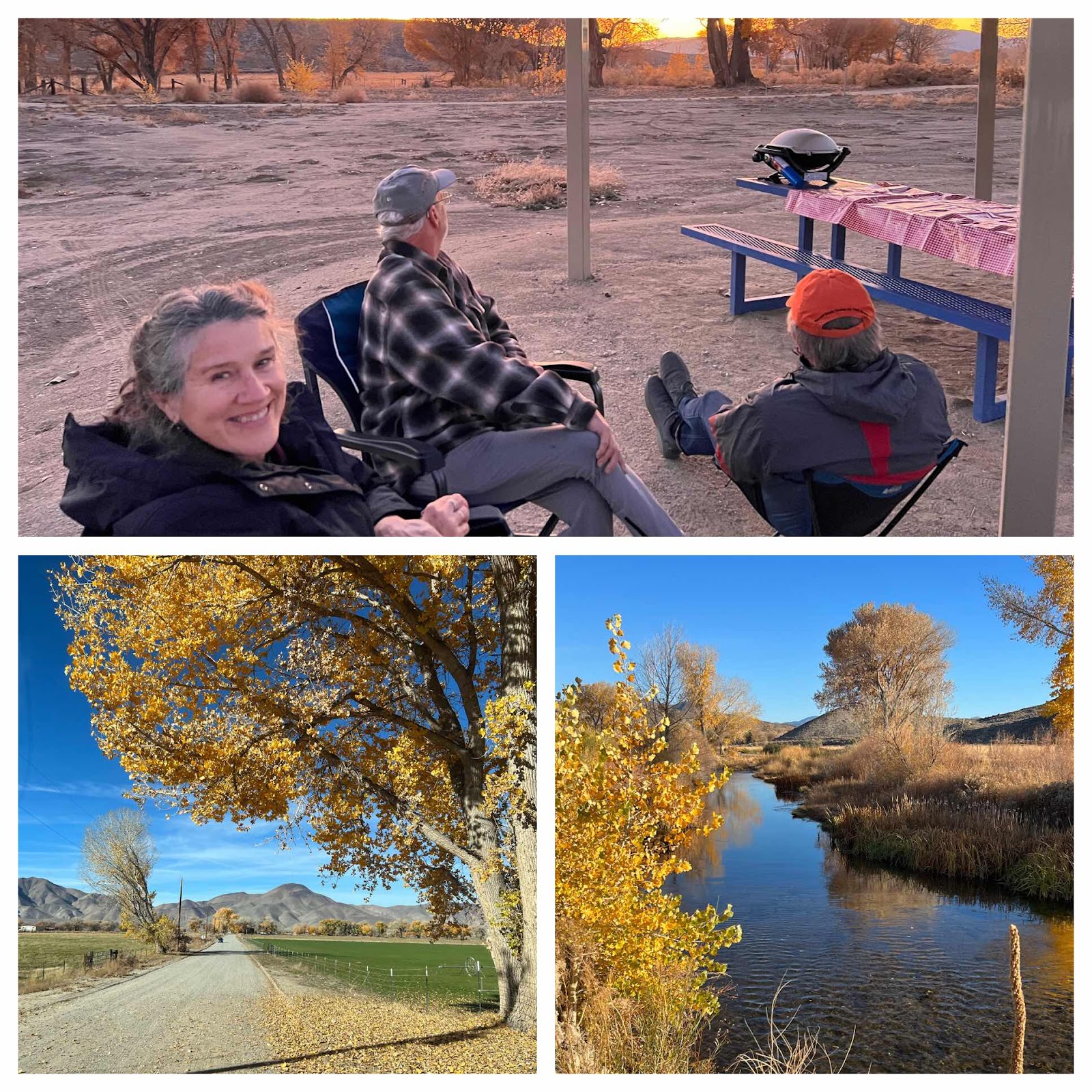
-
 We woke up to sunny but cool weather in the Adirondack Mountains. You can definitely tell that we’re not in New England anymore, because ev...
 -
 When we woke up (rather late) this morning we were equally impressed with the blue skies and to find that we were camped near a sweet lit...
 -
 Location: Boysen State Park, WY Reluctantly leaving Custard State Park our first stop was Jewel Cave National Monument. As far as caves go...