 This is Ned again, taking my occasional turn as blog scribe. The sun woke us up this morning at 6 a.m. and we got up at 6:30, eager to explore the canyon on our bikes before the sun warmed things up too much. After breakfast, we drove Winnie down to the visitor center, and started our bike tour of the Chaco ruins. We almost had the place to ourselves. Walking around the ruins, especially Pueblo Bonito, was really magical. Having first visited here about 15 years ago, I am still amazed with the intricacy of the stonework. We both marveled at being able to walk through some of the actual rooms in the pueblo, with their very low doorways (actually, almost perfect height for Debi), and try to imagine what it would have been like to live here about 1000 years ago. About 10:30, having logged 10 miles on our bikes, we were ready to attempt our exit from Chaco over the dreaded 16 miles of washboard road. Rather than repeat the disaster of the night before, we stowed the bikes inside the van. With Debi praying the whole way, and me driving like an old lady (35 mph on our way in and 15 mph on our exit), we mercifully made it to the paved road after a very long hour without losing any parts or bikes. We made several comments for the rest of the day regarding the amazing technological marvel of asphalt roads. We drove to Farmington, a very large city seemingly supported by an economy associated with the creation and maintenance of oil wells and natural gas fields. The upside of this was that we were quickly able to locate an auto parts store where I purchased some very long stainless hose clamps. I set up shop in front of a nearby motel that offered free Wi-Fi, so that Debi could upload her blog and support her political junkie habit. After about 30 minutes of futzing, and only one failed attempt, I was successful in getting the mysterious smog control canister reattached to the frame of the van, where I trust it will stay for the duration of the trip. After stopping for gas, and getting an impressive amount of black grease washed off of my hands, we headed down the road towards the Grand Canyon. We drove past lots of very wide open landscape, most of which is in the Navajo Nation in the northeast corner of Arizona. Our plans were rather vague at this point, and upon reaching the fork in the road of Highway 89 reading “Grand Canyon, South Rim / North Rim”, we chose North Rim! Neither of us has ever been there, it is considered “the road less traveled”, and it is closer to Zion, where we are planning to meet Polly and Eric on Thursday afternoon. We drove past dramatic multi-colored cliffs, under fluffy white clouds, until we arrived at the Navajo Bridge, which crosses the Colorado River right at the beginning of Marble Canyon, just upstream from the Grand Canyon. Having not had showers or electric power the night before, and uncertain of the prospect of a campsite with showers tonight, we pulled into a funky little Route-66 vintage cabin motor lodge, called Lee’s Ferry Lodge. We decided to have a picnic dinner in front of our room with our leftover wine, cheese, bread, apples, and brownies. (See photo of me dining, while watched adoringly by the very mellow, resident dog, “Took”.) It still feels a little like camping, with the pine paneled walls, lack of TV, and microscopic shower, but Debi was VERY pleased to have a shower tonight! We hope to view the Grand Canyon from the North Rim tomorrow morning.
Monday, June 23, 2008
Making It Up as We Go: Lee’s Ferry Lodge, AZ 6/23/08
This is Ned again, taking my occasional turn as blog scribe. The sun woke us up this morning at 6 a.m. and we got up at 6:30, eager to explore the canyon on our bikes before the sun warmed things up too much. After breakfast, we drove Winnie down to the visitor center, and started our bike tour of the Chaco ruins. We almost had the place to ourselves. Walking around the ruins, especially Pueblo Bonito, was really magical. Having first visited here about 15 years ago, I am still amazed with the intricacy of the stonework. We both marveled at being able to walk through some of the actual rooms in the pueblo, with their very low doorways (actually, almost perfect height for Debi), and try to imagine what it would have been like to live here about 1000 years ago. About 10:30, having logged 10 miles on our bikes, we were ready to attempt our exit from Chaco over the dreaded 16 miles of washboard road. Rather than repeat the disaster of the night before, we stowed the bikes inside the van. With Debi praying the whole way, and me driving like an old lady (35 mph on our way in and 15 mph on our exit), we mercifully made it to the paved road after a very long hour without losing any parts or bikes. We made several comments for the rest of the day regarding the amazing technological marvel of asphalt roads. We drove to Farmington, a very large city seemingly supported by an economy associated with the creation and maintenance of oil wells and natural gas fields. The upside of this was that we were quickly able to locate an auto parts store where I purchased some very long stainless hose clamps. I set up shop in front of a nearby motel that offered free Wi-Fi, so that Debi could upload her blog and support her political junkie habit. After about 30 minutes of futzing, and only one failed attempt, I was successful in getting the mysterious smog control canister reattached to the frame of the van, where I trust it will stay for the duration of the trip. After stopping for gas, and getting an impressive amount of black grease washed off of my hands, we headed down the road towards the Grand Canyon. We drove past lots of very wide open landscape, most of which is in the Navajo Nation in the northeast corner of Arizona. Our plans were rather vague at this point, and upon reaching the fork in the road of Highway 89 reading “Grand Canyon, South Rim / North Rim”, we chose North Rim! Neither of us has ever been there, it is considered “the road less traveled”, and it is closer to Zion, where we are planning to meet Polly and Eric on Thursday afternoon. We drove past dramatic multi-colored cliffs, under fluffy white clouds, until we arrived at the Navajo Bridge, which crosses the Colorado River right at the beginning of Marble Canyon, just upstream from the Grand Canyon. Having not had showers or electric power the night before, and uncertain of the prospect of a campsite with showers tonight, we pulled into a funky little Route-66 vintage cabin motor lodge, called Lee’s Ferry Lodge. We decided to have a picnic dinner in front of our room with our leftover wine, cheese, bread, apples, and brownies. (See photo of me dining, while watched adoringly by the very mellow, resident dog, “Took”.) It still feels a little like camping, with the pine paneled walls, lack of TV, and microscopic shower, but Debi was VERY pleased to have a shower tonight! We hope to view the Grand Canyon from the North Rim tomorrow morning.
A Few Bumps in the Road: Chaco Canyon National Park, NM 6/22/08
 This morning we got up a lot earlier - partly because I was excited about exploring so many new things, and partly because we hadn’t adjusted to the time change (gaining an extra hour). We were up at 6:30 and left the campground by 8:00. Our first destination this morning was Tecolate Café. We had seen Guy review this restaurant on Diners, Drive-ins and Dives. It really impressed us and we didn’t want to miss it. I had the pine nut blue corn pancakes and Ned had a breakfast burrito with Christmas (red and green) chili sauce. This place knocked our socks off. One of the best breakfast places we have ever eaten. The staff was friendly, funny and amazingly attentive. The food spectacular! This is one of the few restaurants that actually live up to the hype. We got to the restaurant at about 8:30 and were seated right away. By the time we left, there were at least 25 people waiting to get in! Our next stop was exploring the neighborhoods of Santa Fe and the Old Governor’s Palace Museum. To tell the truth I was really disappointed in the museum. Ned and I have seen our fair share of museums this trip and this one was particularly mediocre, especially considering the $8 entry fee per person. It was two rooms of placards that really didn’t tell a cohesive story. I think back on the museum in Little Rock that was fantastic – it had history about Little Rock, all the governors, an amazing country music costume display, a women’s exhibit, and you also got to view the chambers of the senate and house of representatives. Heck, the Roger Miller Museum was even better. Sorry Santa Fe, you need work on this one…We then continued to stroll thru Santa Fe, checking out all the vendors that were set-up in the plaza for Sunday morning, and even strolled by the oldest house in the U.S. We decided we had enough of Santa Fe and headed for Bandelier National Monument near Los Alamos. This is the cliff dwellings of the Ancient Pueblo ancestors (used to be called Anasazi, but that term has fallen into disfavor by the Pueblo people). We had a fantastic time exploring the kivas, climbing ladders into the caves (check out the photo of me poking my head out), and viewing the petroglyphs. Of course watching the 15 Chinese Buddhist women in straw hats and long gray smocks giggling, singing, and exploring the caves was highly entertaining too. We then decided to do the long trek (4 hours) to Chaco Canyon. It was a stunningly beautiful drive thru a plethora of scenery. We went by a huge caldera, over a mountain range passing some of the first legitimate looking pine trees we’ve seen in weeks, passed by several Indian pueblos, descended to 7000 feet and paralleled the Colorado plateau over the Continental divide. Whew! We finally reached the turn-off point for Chaco Canyon. It’s 16 miles of the worst washboard road I’ve ever been on!! It was so bad that we passed a new pick-up truck that had broken down on the bumpy road. We offered to help, but they were waiting for a tow truck (how it was getting there with no cell phone service was news to me). We ventured on and finally made it to the park entrance only to realize that we had lost one bike (mine), were dragging the other bike (Ned’s) and poor Winnie had something shaken loose from underneath. The campground radio broadcast stated that the campground was full and there was no way in hell I was going to drive that bumpy ride back out the same day. So, we took inventory of Ned’s bike, decided it was ride-able and I hopped on it in search of a campsite while Ned returned to locate my bike. Turns out there were plenty of campsites (the radio broadcast was old). In the meantime, Ned located my bent bike and spent some time trying to tie up something underneath the car. We finally reconvened at the campsite, Ned jacked up the car and managed to secure what we think is the smog canister. (We donated parts of our campfire “toaster” for this). He also worked on straightening out my bike’s wobbly back wheel. Meanwhile, I worked on getting dinner together (grilled swordfish in mango teriyaki sauce, spinach salad, fresh sourdough bread, corn on the cob and if you promise not to tell the ranger, a bottle of wine). So, here’s hoping that we can take the bikes for a spin thru the park tomorrow and visit the Chaco Canyon ruins and more importantly be able to drive OUT of the park without losing any parts). Stay tuned for part 2. On the plus side, we are in the middle of the high desert with no civilization close by, and the stars are so bright you can touch them!
Saturday, June 21, 2008
Land of Enchantment: Ranchero Santa Fe Campground, Santa Fe, NM 6/21/08
 Once again we got up about 10ish. Geez, you’d think we were on vacation or something.
By the time we left the campground and worked our way out of the canyon it was close to 12:00. Our first stop was Cadillac Ranch, and yep, it’s 10 cars stuck in the dirt. You park your car on a frontage road next to the freeway and walk thru a recently plowed (and muddy field from the rains) to get a close-up view of the cars. They are all heavily covered with graffiti, and it is encouraged for people to add their own markings. It’s a work of art in progress, so to speak. We continued traveling on I-40, getting off at various towns to pick up the Historic 66 route. My favorite town was Tecumcari, TX that seemed to have the most preserved/undemolished vintage architecture. The best was a motel called Blue Swallow wherein each unit came with it’s own one-car garage. It was also billed on the neon sign as “100% Refrigerated” – classic. We also had fun looking at Route 66 souvenirs and chatkis at the Tee Pee Curio shop. We finally made it to Santa Fe at about 5:30. We found a private campground that is fairly close to downtown that is pretty good. Turns out the state park doesn’t have showers and only has pit toilets. Yeah, that ain’t gonna work! The best thing about this campground is that it has free wireless and laundry facilities. After taking advantage of both, we headed downtown to check it out. I LOVE IT! This is definitely my favorite city of the trip so far. The architecture, artistic vibe, amazing history – this place has it all. Seems like everyone was out tonight and it was fun to ride our bikes around the Old Santa Fe square checking out all the musicians playing, people eating outside and strolling through the streets.(I snapped this photo when we first came into town). After riding our bikes for about 4 miles, we decided to stroll through all the courtyards and find a fun place to sit outside and have dinner. This place is really magical and I completely understand why New Mexico is called the Land of Enchantment. Ned thinks I’m just gaga over the place because there are no mosquitoes, no humidity, and it’s the summer solstice. (Yes, there was also some drinking involved). I’m liking it so much that I’m hoping to spend an extra day here. I really enjoyed seeing the Oldest Church in the US, and tomorrow we’d like to check-out the History Museum and some other churches. So, if you hear from me manana we stayed in town. If not, we’re headed to Chaco Canyon National Monument where there is no water, no electricity and obviously no internet. We’re playing on spending sometime exploring the Anasazi Culture. I’ll keep blogging and post when we reach civilization. In the meantime, Happy Summer everyone!
Once again we got up about 10ish. Geez, you’d think we were on vacation or something.
By the time we left the campground and worked our way out of the canyon it was close to 12:00. Our first stop was Cadillac Ranch, and yep, it’s 10 cars stuck in the dirt. You park your car on a frontage road next to the freeway and walk thru a recently plowed (and muddy field from the rains) to get a close-up view of the cars. They are all heavily covered with graffiti, and it is encouraged for people to add their own markings. It’s a work of art in progress, so to speak. We continued traveling on I-40, getting off at various towns to pick up the Historic 66 route. My favorite town was Tecumcari, TX that seemed to have the most preserved/undemolished vintage architecture. The best was a motel called Blue Swallow wherein each unit came with it’s own one-car garage. It was also billed on the neon sign as “100% Refrigerated” – classic. We also had fun looking at Route 66 souvenirs and chatkis at the Tee Pee Curio shop. We finally made it to Santa Fe at about 5:30. We found a private campground that is fairly close to downtown that is pretty good. Turns out the state park doesn’t have showers and only has pit toilets. Yeah, that ain’t gonna work! The best thing about this campground is that it has free wireless and laundry facilities. After taking advantage of both, we headed downtown to check it out. I LOVE IT! This is definitely my favorite city of the trip so far. The architecture, artistic vibe, amazing history – this place has it all. Seems like everyone was out tonight and it was fun to ride our bikes around the Old Santa Fe square checking out all the musicians playing, people eating outside and strolling through the streets.(I snapped this photo when we first came into town). After riding our bikes for about 4 miles, we decided to stroll through all the courtyards and find a fun place to sit outside and have dinner. This place is really magical and I completely understand why New Mexico is called the Land of Enchantment. Ned thinks I’m just gaga over the place because there are no mosquitoes, no humidity, and it’s the summer solstice. (Yes, there was also some drinking involved). I’m liking it so much that I’m hoping to spend an extra day here. I really enjoyed seeing the Oldest Church in the US, and tomorrow we’d like to check-out the History Museum and some other churches. So, if you hear from me manana we stayed in town. If not, we’re headed to Chaco Canyon National Monument where there is no water, no electricity and obviously no internet. We’re playing on spending sometime exploring the Anasazi Culture. I’ll keep blogging and post when we reach civilization. In the meantime, Happy Summer everyone!
King of the Road: Palo Duro Canyon State Park, TX 6/20/08
 Well, it never did rain last night (poor Winnie could really use a shower), but it did cool down enough to sleep comfortably without the fan. We were all fired up to continue down Route 66 and left camp about 9:30. Ironically, we didn’t get very far because we were just having too much fun puttering around the old towns, spotting the bygone icons and stopping at museums and roadside stands. On a whim, Ned pulled into the town of Erick, Oklahoma to drive by the Roger Miller Museum. This is a one stoplight town and looks completely deserted. We thought, what the heck, let’s go inside and poke around. One of the best decisions of the trip! We were greeted by a very sweet woman who gave us a personal tour, including a description of every piece of memorabilia, and told us more than one could ever hope to know about Roger Miller. He’s from the town of Erick and they are VERY proud of this home town boy. We thoroughly enjoyed her stories, seeing original lyrics written out on scraps of paper, the clothes, posters, record albums, motorcycle – you name it. To fully appreciate the ambiance of this place, let me explain. The entire “museum” is one room and then we were lead into an adjoining room that had cloth covered card tables. We were asked if we would like a soda (served in a styrofoam cup with ice) and watched a 50 minute video on Roger Miller. All this for the price of $3! (Once again, Mr. Ned was singing along to the songs, even the more obscure ones.) By this time it was after 1:00 and we decided to eat lunch at the Main Street Café next door. The waitress took our order while holding her one year old daughter, Madison, on her hip. The good folks at the next table, two men dressed in denim overalls and baseball caps, struck up a conversation with us. They were telling us about the weather and how everywhere it seems to be flooding, but in this piece of the world they were experiencing a drought. They wanted to know where we were from, what we’ve seen and where we were going. They completely approved of us heading out to Palo Duro Canyon State Park, but thought we were crazy to want to see Cadillac Ranch. As one gentlemen put it, “It’s just a bunch of cars stuck in the dirt, what do you want to see that for?” By the time we left, we realized that we had traveled maybe 45 or 50 miles in 4 hours! At this rate, we were never gonna make Amarillo. Still not feeling hurried, we continued to explore the old Route 66 towns (while singing along to our new Roger Miller CD – “King of the Road” - and some Johnny Cash), seeing leaning water towers, 150 foot steel crosses, and old cowboy signs. Too much fun! We finally reached Amarillo and decided to visit Cadillac Ranch tomorrow and instead head straight for Palo Duro Canyon State Park. WOWZA! This place is amazing! It is 120 miles long, 800 feet deep and the second largest canyon in the United States. It’s so beautiful that you swear you are on a Disney wild west set and this is make-believe. (The photo really doesn’t do it justice.) The cool thing is that our campsite is way down at the bottom of the canyon and we are surrounded by these great, bright red claystone and white gypsum cliffs. We couldn’t wait to jump on our bikes and go for a ride. They allow bikes on the trails and we had a blast riding through the canyon floor, up and down trails, through Juniper and mesquite trees, and over wooden boardwalk bridges. We even passed a place called “Toad Suck Bog”, not sure about that one… At one point I had to get off and walk my bike up the trail it was so steep. (Ok little bro Scott, if you’re reading this I know you could have taken it straight up but I’m pleading girl and being 50). We only did about 6 miles, but it still felt good to stretch our legs. Turns out it was a good decision that we headed right for this State Park since there were only two spots left on this Friday night. It would have been a shame to miss this. There are a lot of activities to choose from this evening: a Texas Hoe-Down Bar-b-que, A Texas Musical put on at the amphitheatre, and an interpretive night hike along the canyon floor with flashlights. Of course, there’s also hanging up the hammock and doing some chill time. Right now this ol’ cowgirl is gonna hop in the shower and get rid of some serious road dust. Addendum: it’s the next morning and we had the most spectacular lighting and thunderstorm last night! The storm passed right over us and the blinding lighting, booming thunder and torrential rains were really thrilling. Ironic that we didn’t encounter any rain in the south, but caught up with it in the desert. It was also a bit of an adventure getting out of the canyon this morning. We had to ford through FIVE waterways where the flash floods took over the roadway. I was a bit nervous, but Ned calmly steered our way up and out of the canyon. Poor Miss Winnie is more red then white!
Friday, June 20, 2008
Getting our Kicks on Route 66: Foss State Park, OK 6/19/08
 This entire road trip is really about the journey and not the destination. Nothing captured that spirit more than today. We did our best to leave the campground early (for us), and managed to be on the road by 8:30. We finally caught up with Route 66 just south of Tulsa at Sapulpa by about 10ish. We had a guidebook to point out some of the old icons on the Route, but half the fun was trying to spot them ourselves. On several occasions we did a couple of laps through the small towns to find the old gas stations or motor car motels that were hidden among the modern day logos. Today’s photo was taken of a gas station in Davenport, just sitting there by itself without any history markers. I kinda liked that! (BTW- this place is for sale if anyone is interested). Route 66 from Tulsa to Oklahoma City seems to be more in tact than other sections and it’s easier to follow. It was crazy trying to follow it through Oklahoma City, especially since the Route in this location is mostly expressways or freeways through the city. I am still quite surprised at how beautiful Eastern Oklahoma is! Everything is lush and green, with beautiful rolling hills and lots of rivers and streams. I’m really glad I saw this firsthand. I always imagined Oklahoma to be like the dust bowl in Grapes of Wrath, geez was I wrong. Once we finally got through Oklahoma City and connected up again with Route 66 we enjoyed stopping at the town of El Reno. We spotted several of the original road icons and, after consulting our “Road Food” book, we settled on Sid’s a true roadside burger stand. The big “thing” in this part of the country is onion burgers. Basically, it’s hamburgers with a baseball size of onions that are grilled with the burger. The onions and burger get all mushed together and the onions sticking out become carmelized. (Glad I tried it, but don’t see it in my future.) This was washed down with a chocolate malt. (burp). We proceeded to the town of Clinton, listening to some tunes on the ipod we thought were appropriate – Patsy Cline, cowboy singer Johnny Prine, and some other road tunes I put together. Ned, by the way, has kept me entertained for 6,000 miles with his singing. Once again, he surprised me with some cowboy and folk songs. Did you know he plays the banjo, too?! I think that’s where he got his hillbilly repertoire. We spent an hour or so at the Route 66 Museum in Clinton and boy, was that fun! Each room represents a specific decade of Route 66’s past. As you enter the room, the most popular song from that time period is playing, you can read about the road’s history (such as being built, the heyday of the route, etc) and tons of period specific items are on display. At the end there is a 20 minute movie about the Route. We really enjoyed this museum, especially playing with the old gas pumps, posing near the cars, and remembering are own family vacations as kids. Both Ned and I grew up doing family road trips/camping trips and have been swapping all our stories. (Yes, both our dads strapped the canvas water bag to the radiator on the car. We had an old Rambler Stationwagaon, Ned’s family had a Pontiac Bonnieville Stationwagaon.) We enjoyed ourselves so much puttering around all day that we decided not to push it and try for Texas tonight. We looked at our trusty State Park book and found a campground close by Clinton. It’s very much a “Home on the Range” type campground (i.e. camping in a grass field), but we are just enjoying hanging out, going for a bike ride and luxuriating in the cool evening. (It hasn’t actually rained, but the weather sure feels like it). Tomorrow continues Route 66 and more fun – perhaps the Cadillac Ranch.
Thursday, June 19, 2008
Cherokee Nation: Sequoyah State Park, OK 6/18/08
 Well, we were both exhausted and slept in until 10:00 this morning! By the time we left the campsite and moseyed on out it was close to 11:30. Mmm, this meant a slight adjustment in plans, most likely picking a different destination for the night. We also decided to drive some scenic back roads and possibly do a side trip to the Cherokee Heritage Museum. Driving thru the Ouachita National Forest (slightly lower than the Ozarks) was beautiful. I caught some really gorgeous photos, but decided not to post it tonight on account of something else that came up. (Keep reading). At about 3ish we entered Oklahoma, made a quick stop to the Visitors Center, and decided to definitely take the side trip to Tahlequah, which is pretty much the seat of the Cherokee Nation. I really wanted to see the detailed exhibit and learn about the “Trail of Tears.” We took an absolutely gorgeous road through rolling hills that followed creeks, rivers and lakes. I had no idea that Eastern Oklahoma was this gorgeous. We got to the museum at about 4:00. The host let us in for free (on account of it being only open for another hour) as long as we promised not to take any photos. I loved this museum and learned so much! For example, the written Cherokee language is based on a syllabary and not an alphabet; it was developed by Sequoyah in the early 1800’s; the forced migration involved 16,000 people of which more than 4,000 died; and the beloved Will Rogers is Cherokee and from this area. The individual stories of the migration were so sad, but what really brought tears to my eyes is the resilience of the Cherokee people. The museum also focused on the aftermath of the migration and how the different tribes assimilated and rebuilt their nation. I was also impressed with the emphasis on education, especially among the women. Very inspiring. My friend Julia Bushyhead is from this area and suggested we visit a Braum’s to get an almond chocolate shake and be sure to try out the local chicken fried steak. (Julia, if you’re reading this, duly noted – both were accomplished. Ned especially loved the shake). We drove to a nearby campground (Sequoyah State Park), which is about 30 minutes from Tahlequah and right on Gibson Lake. We pulled in around 6:30 or so and much to our surprise almost every campground was flooded! Apparently, there has been a lot of rain in Kansas, which has put a strain on the rivers in Oklahoma. (We’ve been blessed with great weather so far. I know the floods have hit other areas, but we only saw rain in the Great Smokey’s and a few drops at Balmorhea, Tx). This lake is based on a series of upstream dams and they are overloaded. We spoke with the local ranger and for every foot of water they let out of the first dam it translates to 10 extra feet here. They are now 24 feet above normal. Check out the picture of the campground sign. Needless to say ALL the camping sites were under water (completely submerged), including picnic tables, electric boxes, and grills. The ranger took us to an alternate campground, which is totally empty except for us - and about 200 Canada geese. Most of the campsites are underwater, but there were 1 or 2 where the electrical boxes still worked. Tomorrow we connect up with Route 66 out of Tulsa. (We are about an hour from there). Tonight, we are pouring over several maps and tourist books to figure out just what to see – so many road stops and options! We are anticipating a long 7-8 hours in the car so hopefully we’ll get up a little earlier tomorrow!
Wednesday, June 18, 2008
Big River and Little Rock: Petit Jean State Park, AR 6/17/08
 This is Ned filling in for Debi again. Turns out one of the disadvantages of T.O. Fuller State Park in Memphis is it’s proximity to the airport. Guess who makes (what seems like) hundreds of take-offs and landings around 3 a.m. in Memphis? You guessed it: FedEx, because Memphis is their national hub. Anyway, Debi says she didn’t get a lot of sleep last night. Meanwhile, I apparently slept through all the noise (possibly from my years of training near the Oakland airport?) Anyway, this morning began with us riding our bikes on the pedestrian walkway above the monorail tracks over to the River Walk at Mud Island. The advantage of being one of the first people there after they opened the gates at 10 a.m. was that we got to ride all around and scope out the whole place with almost no one else around. My sister Polly had recommended that we see this place. It’s a half-mile long, concrete scale model of the Mississippi River running all the way from it’s head waters to the Gulf of Mexico. Fascinating! The other fun thing about it, besides being very informative about many geological and historical facts about the river, is that little kids just LOVE to wade in it! There was one group of moms who had a group of about 10 very little kids, every one of them intently wading around the curves of the scale model river with their little Crocs on! While on our bikes, we also checked out the housing on the north end of Mud Island. It looks like a very tastefully planned community with many great looking houses. Debi thought it would be a fun place to kayak from every morning, if she lived there. While we were overlooking the Mississippi we also saw acouple of huge tug boats pushing about 10 barges each up river. It really gives you an appreciation for the strength of the river’s current to watch the mammoth wake churning up behind those tug boats to make very modest progress upstream. After leaving Memphis, we headed into Arkansas, speeding along Interstate 40 past lots of rice, corn, and sorghum fields. It made us appreciate the back roads that we normally drive, since the number of Eighteen Wheelers on this stretch of highway was phenomenal. Most of them seem intent on driving about 75 miles an hour too, which makes it a little difficult, if you happen to be trying for a relatively fuel-conserving 65 mph. Once we arrived in Little Rock, we went directly to the Visitor’s Center, where we got lots of great ideas from a very helpful woman. We then took our bikes and found the Farmers Market along the river. We found a great place for lunch called the Flying Fish where we both had a different version of catfish. (See photo of me in front of their wall of fanciful artwork waiting for my lunch to arrive.) Debi had catfish grilled with veggies, while I had mine fried in a Po’Boy sandwich, accompanied with fries and hush puppies. Both were delicious. Debi says she has missed eating real vegetables! (No, fried Okra doesn’t count.) After that we spent quite a while in the Old Statehouse Museum, which had some really excellent displays, but which the most noteworthy were Bill Clinton’s running shoes (New Balance) and saxophone, along with Hillary’s Inauguration Ball dress, when Bill became governor of Arkansas (really matronly!) We also biked and drove around some of the rest of Little Rock. Debi was especially impressed with what a pleasant looking little town it is, with lots of very stately older homes. We then headed along the back roads toward Petite Jean State Park, passing through some very beautiful wooded countryside, and along some spectacular lakes. Right before arriving at the park we pulled into a little overlook which gave us an amazing view of the Arkansas River meandering below with lots of lush farmland spreading in all directions. This park was the first state park in Arkansas, established around 1928, with the registration headquarters having the rustic look of something made during the 1930’s by FDR’s CCC. We don’t know yet whether we’ll hang out here for just one night, or maybe two. We plan to play it by ear in the morning.
Subscribe to:
Posts (Atom)
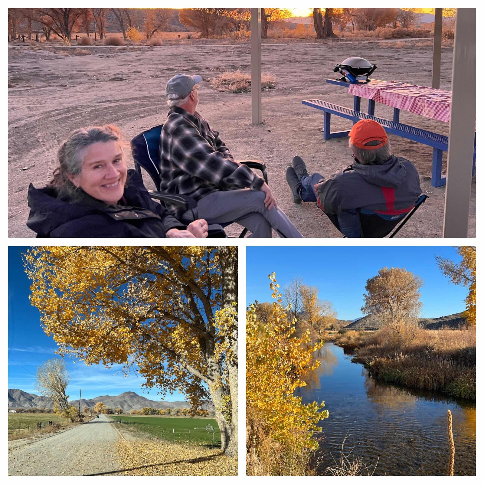
Eastern Sierras with Leila and Mike
Walker Ranch Recreation Area & Benton Hot Springs, We spent the last 4 days going off grid and exploring some unique areas around the hi...
-
 We woke up to sunny but cool weather in the Adirondack Mountains. You can definitely tell that we’re not in New England anymore, because ev...
 -
 When we woke up (rather late) this morning we were equally impressed with the blue skies and to find that we were camped near a sweet lit...
 -
 Location: Boysen State Park, WY Reluctantly leaving Custard State Park our first stop was Jewel Cave National Monument. As far as caves go...