Monday, June 9, 2014

Cape Breton, Inverness Side

Cheticamp, Cape Breton Highlands National Park

Blue skies and warmer weather, looks like a good day for a drive. We crossed over Canso Causeway, leaving Northumberland Shore behind us and ready to explore Cape Breton. We decided to go round the cape via the Northumberland Straight side first (clockwise) and ending up on the Atlantic side tomorrow. Our reasoning was we eventually want to see the Alexander Bell Museum and it's not open til Wednesday.

Cape Breton is split down the middle by two sides - Inverness County on the west and Victoria County on the east. As one travels up the western side, the first section is called the Ceilidh (pronounced Kay-lee) Trail, named after the Celtic Music and dancing of the Scottish Highlands. The scenery is breathtaking varying between groves of fir trees, wide vistas of the Straight and lots of rolling hills. This area has very proudly retained their Scottish culture and language. The town names and signs are in both English and Gaelic. There are many pubs and music halls along this stretch that feature lots of Celtic fiddlers, pipers, guitarists and singers. We had wanted to spend some time at the Celtic Interpretive Music Centre, but unfortunately it doesn't open til next week, in time for the high season. We decided to take in a distillery instead.

The Glenora Distillery specializes in single malt whisky, and in fact are the only single malt whisky makers made in North America that makes aged (at least 10 year old) whisky. Apparently there are a couple of upstarts in British Columbia. Ned, continuing his research for constructing his own still, was looking forward to the tour. In reality they weren't brewing right now. They don't brew during the summer months, they claim, for safety reasons. Ned suspects it has to do more with keeping the production low and driving up demand. Our tour guide was friendly, but a little jaded. I think he had done a couple of tours too many. My favorite part, of course, was the tasting. Damn good whisky! Afterwards we had a picnic with the smoked salmon and pumpernickel bread we had purchased yesterday in the sun. The best part was that it was in the sun. Not taking that for granted!

We continued our drive up the Cape and when we crossed over the Margaree Harbor we had left the Ceilidh Trail behind and begun the Cabot Trail. This part of the coast is even more wide open with luscious green rolling hills and incredible views of the water. It reminded us very much of Highway 1, particularly around Jenner and Mendocino. This is the Acadian Region and the signs are now in French and English. When the English had forced many of the Acadians from Nova Scotia, some of them had hid out in the highlands of Cape Breton (rather than swear allegiance to the British Crown) surviving some pretty harsh winters. Finally, years later when they were allowed to return they settled back in this area and til this day very proudly retain their French language and culture.

This afternoon we are camped at the beginning of the Cape Breton Highlands National Park in the Cheticamp Campground. We discussed doing a bike trail (this place is famous for some of the best biking on the planet) but honestly have decided to just take it easy soaking up the sun. We decided it was a good opportunity to break out our bottle of Nova Scotia wine. (Don't worry California, you have nothing to worry about). Reading and napping won out.

Tonight we rallied and went into town for a lobster dinner. Dang they grow them big up here! Ned got a 2.5 pounder. After dinner we took a drive along the Cabot Trail and were the only people on it. Amazing. We were in search of wildlife - whales, moose, bear or coyotes. Didn't catch any of those, but we did stop on a bluff to catch a beautiful sunset over the calm waters. Okay peeps back home, we are 4 hours ahead of you. I've just said good-bye to the sun and am passing it along your way to put it to bed. See you all tomorrow.

Sunday, June 8, 2014

The Eastern and Northumberland Shores, Nova Scotia

Hyclass Ocean Campground, Havre Boucher, Nova Scotia

We woke to blue, blue skies and much appreciated relief from the overcast and drizzly days we've been having. It was still a bit cold, but I will take the sunshine anyway I can get it.

Our route this morning took us to the Eastern Shores of Nova Scotia. I believe it's the most remote and least populated of the Nova Scotia shores, at least it seemed that way to us. We got a kick out of all the strange sounding "towns" (just houses) that we drove through such as Head of Chezzetcook, Mushaboom, and Ecum Secum. This area is heavily wooded and has few services of any kind on the main road. The houses we did glimpse were rather modest or trailer homes, no longer "salt box" design or period pieces. Given the lobster traps we saw in front of the houses we did glimpse, we assumed the main industry in this end of the island was fishing. It's currently lobster season, so we weren't surprised by all the lobster traps. We stopped by a small smoked fish operation to pick up some smoked salmon. Yes, it was nice to take a break from lobster and the ubiquitous potatoes that accompany everything. Unlike the Lighthouse Route, there really aren't many fishing villages, coves or inlets. The two big "cities" are Sheet Harbor and our destination, Sherbrooke.

In my opinion, Sherbrooke is a real national treasure. It was an actual town first established in 1840 and was thriving until 1916. The majority of the residences were Scottish. The courthouse in town was functional until the year 2000! Sherbrooke Village is a period living re-enactment place, one that cost an admission, but what makes this so different from others is that almost everything is original and still functional. We spent over 3 hours here visiting all the shops such as the blacksmith, pottery, boat making, tailors, and private residences. My favorite was visiting the "gaol". The original jail was in someone's home!! There were two iron gate doors placed on bedrooms and the family was compensated for taking care of the prisoners. It was so interesting to see the parlour, kitchen, bedrooms and 4 jail rooms. I can't imagine raising a family as I housed prisoners. Each place we visited had a person, in period costume, explaining the customs or trade of their situation. The woman who housed the prisoners was making rhubarb tarts in the wood burning oven and offered us some. Yes, every home is still functional and most had fireplaces and ovens going and the water pumps in the houses still worked. The tailors shop and pharmacy still had all the original equipment or tinctures and ointments in them! Amazing.

By far, what I loved the most was the telephone exchange! Alexander Bell was a resident of Nova Scotia (Cape Breton) and invented the phone in 1875. This town installed the phone soon after, in 1877. Because there were several mines in the area it was important to the owners to have a quick system of communication. At the turn of the century a telephone exchange was installed in this town and is still working today - yes the original exchange. You can call 9 people in town. A gentlemen was sitting at the switchboard and showed us how the electric current generated from cranking the phone flipped a little metal flap on his switchboard. He could then see who was calling and connect them to another person in town. He demonstrated the receiving and outgoing wires and how they worked. I asked him if I could give it a try and he said "Go for it!" I initiated a call to Joann, the woman who was baking the rhubarb tarts in the jail home. When she picked up the phone I thanked her for them, much to her surprise. Glen, the phone operator, could hear the whole transaction. What a riot. How many towns in this world still have the original phone exchange between the houses?!

This town is situated right on the St. Mary's river, so one could see how the local provisioners or grocery store received a shipment from the dock off the river right into their store. I LOVED seeing a real butter churn with a treadmill attached. A dog would run on the treadmill to churn the butter. Too funny.

Ned enjoyed the working water sawmill. We got to see how a water wheel ran a series of pulleys that in turn ran an up-and-down saw that cut through logs. We took a nature trail through the woods and were able to see the logging camp, how the loggers lived and floated the logs down river to the mill. There was also a gold mine and stamp mill. That we know enough about, so we weren't so blown away by that.

From Sherbrooke we headed due north for the Northumberland Shore. As we drove through very fertile farmland it came as no surprise that this was the area inhabited by the English and Scots. One of the largest towns in Northumberland is Antigonish, a charming town that hosts St. Francis Xavier University and is known for it's Scottish culture. It's very modern and upscale and could pass for any tourist town except for all the Scottish Gaelic on the signs. We thought about camping here, but just weren't into the whole shopping, golf scene experience so we continued to the tip of Northumberland just across the way from the Island of Cape Breton. We're looking forward to exploring the Cape tomorrow and hope the weather holds.

Saturday, June 7, 2014

The Lighthouse Route

Porter's Lake Provincial Park, Nova Scotia

We left the Western shore of Acadian Coast behind us and crossed over onto the Southern area known as the Lighthouse Route early this morning. Unlike the Acadian coast which was sparse and sprinkled with saltbox houses here and there overlooking wide vistas of Fundy Bay, this stretch of Nova Scotia was heavily wooded and had many more villages, coves and peninsulas. Our goal over the next week is to drive the circumference of Nova Scotia. Considering that its coastline is 4625 miles, we definitely have to pick and chose which peninsulas to explore. No easy feat considering each cove, bay and tiny fishing town seems to have an interesting story. We even saw a boat that had run aground attesting to the difficulty of trying to navigate these treacherous waters, especially with their crazy tides.

After pouring over guidebooks and talking with locals we finally decided which nooks and crannies to see. The first little town we explored was Birchtown. After the American Revolution over 3500 free African-Americans, loyal to the Crown, moved to Nova Scotia and New Brunswick. Birchtown was the largest of the settlements. Their population eventually declined due to how poorly they were treated and in 1792 many of them emigrated to Sierra Leone, West Africa. The land they were given by the British was really poor rocky soil, much like the inferior land the Acadians were given.

Continuing to hug the coastline, we moved onto Shelburne. During the American Revolution many pro-British refugees gathered in New York. The wealthier class went to England, but most of the less affluent sought refuge in Shelburne, Nova Scotia. Their population mushroomed from 400 to 10,000 in one year! By the year 1800 only 300 families were left, many families resettling elsewhere. Okay, what struck me the most about this was I never thought about the Americans who remained loyal to the British. I just assumed that everyone wanted to be free of British rule or at least wanted to stay a part of the colonies. Guess I missed that one in school. We were really looking forward to seeing this town, partly because its waterfront had some of the original structures and partly because it was the Lobster Festival this weekend. The architecture and waterfront did not disappoint! I loved the old dory building and other colorful buildings. However, the Lobster Festival was a disappointment. The huge town-wide flea market seemed to get a bigger draw. Just as well, how much lobster can one really eat anyway?

True to its name, the Lighthouse Route, this stretch of Nova Scotia had a plethora of lighthouses. We visited many other fishing villages and coves, but of course had to visit the most famous of them all, Peggy's Cove, which is touted as being the most photographed lighthouse in Canada. It's a very tiny village, only 35 residents live here year round, but thousands come to take pictures of the lighthouse. It really is breathtaking to see this lighthouse atop the rocks, with the waves crashing below. The village is very quaint and frankly, it's just hard to take a bad picture here. As if on cue, our overcast skies cleared up, the sun broke out and we were treated to a spectacularly beautiful day. This part of the coast definitely reminded us of Mendocino.

We finally made it into the big city, Halifax. Our plan was to unload the bikes and tour the waterfront, but it was really windy and cold. Instead we decided to tour the oldest brewery in North America, Alexander Keith Brewery. (Pretty good backup plan, I'd say.) It wasn't so much a tour as a show. We really did think we were going to see and learn about their brewery process. Instead we got period actors, dressed up in costume, doing a song and dance show. It was very entertaining and we got to drink a bunch of beer so I'm not complaining. Ned said it reminded him of the Ghirardelli Square in San Francisco. Everyone thinks they are watching chocolate being made, but in reality it's just a show.

Halifax is a very fun city. I love the mix of really old buildings right next to high rises situated on the waterfront. It reminds me a little of Boston with the hills of San Francisco. What's so interesting about Halifax is that there really doesn't seem to be any suburbia or sprawl. Twenty kilometers away and you are once again in the depths of a heavily wooded, very sparsely populated area. We are camped at Porter's Lake Provincial Park, only 22 kilometers from Halifax and it feels like I'm in upper Minnesota with the lakes and trees. Of course, our camping neighbors, a country Nova Scotian group are blasting out their favorite old timey country songs so there is that. Yes, country music seems to be big around these here parts.

Friday, June 6, 2014

Acadian Coast

Thurston Campground, Upper Clyde River, Nova Scotia

We had quite the leisure morning since our ferry from St. John's New Brunswick to Digby, Nova Scotia didn't leave until noon. It was quite the swanky ferry too! Complete with wifi, movies, lounges and a Starbuck's cafe. What I liked best is that it was more of a floating museum with all kinds of interesting exhibits about Nova Scotia. There was a concierge on board who had more knowledge of Nova Scotia than I thought was humanly possible to retain. She loaded us up with maps, books, information on all the coves and nooks and crannies of Nova Scotia.

We crossed the Bay of Fundy which is famous for their incredible tides. It has the highest tide in the world, reaching over 50 feet! Every 6.5 hours or so the tide shifts.
Try navigating those waters! Also about 4 different species of whales live in this area. In fact, if you sign up for a whale tour you are guaranteed a whale sighting. As one person told us, "they love to show off, you will definitely see them."

By the time we disembarked in Digby it was close to 3 pm. We decided to drive route 3 which is the slowpoke drive down the Acadian coast through all the "towns." In reality the towns on the map were just groupings of houses clustered together near the sea. This area is beautifully stark and the houses in this area all have the same utilitarian hard scrabble look. Many homes were also proudly flying the Acadian flag.
There are no or very, very few shops, restaurants or services along this stretch.

Once we reached Yarmouth, the terrain definitely changed. Now, instead of a relatively straight coastline with the road hugging the sea, there were tons of long craggy inlets, much like the coast of Maine. We choose one finger to go down and it seemed very remote. The city of Yarmouth was pretty small, seeming like just a couple of blocks long. Again, it had a fishing, utilitarian look, nothing of the quaint look about it.

I planned on us staying at The Islands Provincial Park near Shelbourne. In reading some of the literature that the ferry concierge gave us I noticed that it didn't open until June 13th. oops. Time to try and find a campground after 7 pm. We have no cell and no internet, just the maps and literature to rely on. Reminds me of the days when we first started roadtripping. I located a private campground on the Upper Clyde River, "where the river meets the sea." Ned and I got kind of a kick out of this since every mile or so has a river that meets the sea. We pulled into the campground and as expected it's pretty much a dirt parking lot next to the river. It has showers, a flush toilet and good enough to call home for the night.

We were starving and the owner, Tanya, recommended a restaurant called "Anchors Away" that was just a few kilometers down the road. It also happens to be their opening night. Okay, we'll bite. (p.s. they have wifi which is allowing me to quickly write this blog and post it before heading back to the campsite). The restaurant is so local and very Acadian authentic. Our waitress, who is a delightful Acadian woman, was so patient with us explaining some of the local dishes. Ned had the Rappie pie with molasses, butter and brown bed and I had haddock fish cakes with chow-chow.
The rappie pie is basically a potato starch (grated potatoes that have the liquid squeezed out), layered with chicken then baked for 2.5 hours. Ned said it tasted like chicken pot pie, I thought it just tasted like potatoes. My fish cakes tasted like potato pancakes, (not a big fan) but I loved the chow-chow, which is pickled onion relish.
Everyone in this restaurant are locals and they are all greeted by name as they enter.
Some of the locals asked me where we were from, they said with my tan I didn't look like I was from around here. Haha. The folks here are just so friendly. One couple just invited us to come by their house and see the boat they were building, with their grandsons. "We're just ten minutes down the road." I've included a picture of Ned with our Acadian waitress, Nancy. Adorable.

The Magic of Acadia

New River Beach Provincial Park, New Brunswick, Canada

The last time we visited Acadia National Park was in the fall of 2009. We've always said it was our favorite park and five year later I still agree. What makes this park so cool are the 45 miles of carriage roads. So many National Parks aren't incredibly welcoming to bike riders and this park caters to them. The carriage roads were built by the wealthy elite of New York at the turn of the last century. As they "summered" on this island, the carriage roads were for their viewing pleasure. Every bend has a view of the ocean or is situated next to a pond. The roads meander up and down hills, over bridges, along waterfalls and through the woods. It's simply breathtaking.

We got an early start this morning, partly wanting to take advantage of the break in the weather and partly due to the journey we had planned into Canada. For the next several hours we rode or just stopped to take photos and soak in the early morning quiet and beauty. We ended up riding a good 12 miles. The entire time we never saw one other bike rider.

It's hard to put into words the complete beauty and peace one experiences riding these carriage roads. It's completely quiet, the woods filled with heavy duff and the mist hanging over the ponds. I'm sure optimal conditions would have been to experience this ride in warmer weather and clear blue skies, but it was incredibly surreal to ride in the fog. At one point we came upon a young buck, his antlers just starting to sprout, munching his way through breakfast. Love, love, love this park. I hope we don't wait 5 years to come visit again.

After this work-out we were in desperate need of showers. Fortunately, there is a pay shower station not too far from the park. Just as we entered the building the heavens opened up and boy did it pour! All day long...We couldn't believe our luck in hitting that small window to ride.

We continued to head northeast until we finally came upon the town of Lubec, also known as the most Eastern place in the continental U.S. (So far, Ned and I have visited the most Southern - Key West, the most Western - Fort Stevens, and now the most Eastern. I should look up which one is the most Northern!) The reason for traveling thru Lubec was to reach Campobello, an island off the coast which is part of New Brunswick, Canada.

This was Franklin D. Roosevelt's beloved summer "cottage" where he vacationed as a child and where he took his own family, until he became President. If you've ever seen any movies about FDR, swimming, sailing, etc. most likely it was at Campobello. What I found interesting is that despite this being probably his most sentimental place to stay, he only visited 3 times during the 12 years he was president. Most likely because of his disability due to polio. In 1962 a bridge was finally built connecting the island to the mainland. Before then it was quite an ordeal to get here! "They took a day train from NY to Boston, then boarded an overnight sleeper from Boston to Ayers Junction, ME. The next morning, they, their servants and the luggage (some 40 trunks) took a 15 mile ride on a 1-car train to Eastport, where a boat waited for them for the final leg of their trip to the island."

Today Campobello is a joint International Park between Canada and the U.S. It's jointly staffed and equally funded by both countries. We were able to tour the "cottage": all 14 bedrooms, kitchen, laundry, dining room, game room, porch, etc. My favorite room was the dining room off the porch. In the picture posted below look at that huge megaphone on the left side. It's about 4 feet tall, made of parchment paper so it only weighs 2 lbs., and is therefore light enough for Eleanor to call in the kids for dinner. Ha!

We had to go through a border crossing station to get to Campobello, then cross back into the U.S. We drove due north for another hour, then had to cross again at St. Stephens to get into mainland Canada. While driving up to St. Stephens we passed a marker along the road which indicated that we were crossing the 45th parallel, which is exactly half way between the Equator and the North Pole. (Pretty cool since we were at the Equator a month ago).

We are in a nicely wooded beach campground not too far from St. John. I understand it has a great beach and boardwalk, but between the steady rain and time change it's too dark and wet to really explore. Okay, I'm going to cop to ignorance here. I had no idea that there was an Atlantic time zone in our continent. I assumed all the Maritime Provinces were in the Eastern time zone. It was bizarre to go to Campobello, lose an hour of time, cross over the bridge back into the US and gain it back, drive for an hour, cross the bridge into Canada and lose it again. So, we are now officially 4 hours ahead of California. We no longer have any cell connection so we'll be relying on finding wi-fi when we can. Could take us a bit longer to post updates for the next several weeks. Stay tuned...(The last two photos I couldn't resist. Lobsters and more lobsters!)

Eastern Sierras with Leila and Mike

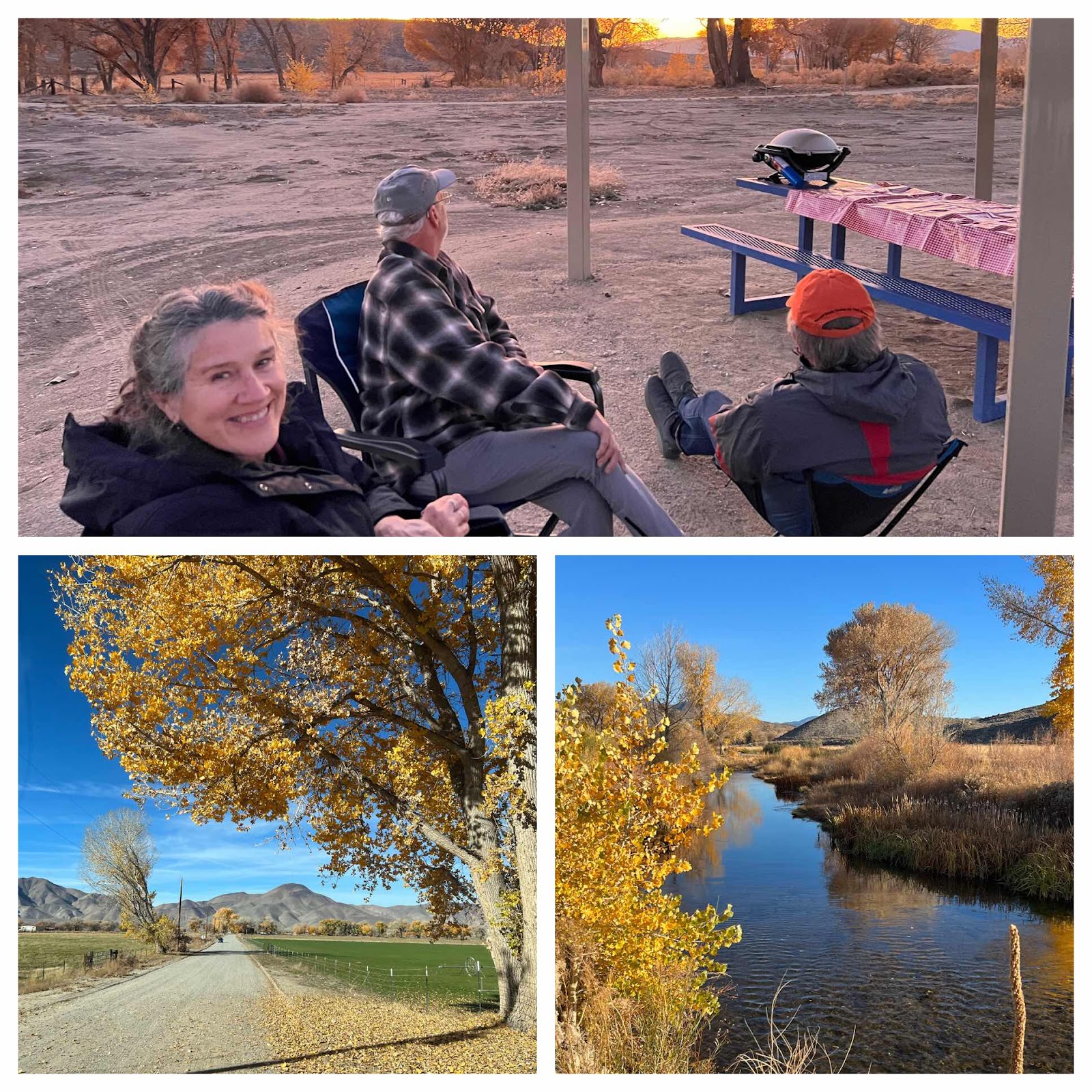
Walker Ranch Recreation Area & Benton Hot Springs, We spent the last 4 days going off grid and exploring some unique areas around the hi...