 We were in total vacation mode and slept in this morning. In fact, I think we were still gathered around the breakfast table, chit-chatting away at 11:15. Nice! We finally pulled out of Nancy’s around 12:30 and decided to take Highway 1 and enjoy the coast. Ned’s parents used to live in Pescadero and he thought it would be fun to take a drive through the town. What a great decision! There’s a local restaurant called Duarte’s (pronounced Doo-Arts. I’m sure my Portuguese ancestors are rolling in their grave at that pronunciation!). Ned’s family has eaten there for years and we recently saw it on the show “Diner, Drive-Ins and Dives” so we decided to stop in for lunch. (Yes, day two and we are already eating our way through the US). I had a bowl of the best ever artichoke soup, Ned had a crab-melt and we split a piece of Ollalieberry pie, a-la-mode, of course;-)
We also visited the Russell Administrative Building named after Ned’s parents, Oak and Marion Russell. It was so sweet to see their picture and plaque in the lobby. After hearing all these wonderful stories about his parents and how much they gave back to the community, it brought tears to my eyes to see how much they are still honored. We also drove by their old house, an amazing place that sits high up on Bean Hollow Road surrounded by artichoke farms, with a great view of the Pacific Ocean.
We continued down the coast highway cutting over to Salinas and then headed down to Arroyo Grande. We pulled in at Polly & Eric’s place around 6ish. Eric built a huge deck, about 2000 square feet, that overlooks the valley towards Lake Lopez. (Hey, Patti I’m sure we can see your brother’s place!). The above photo is taken from the back deck.
It was great to catch-up with Eric and Polly. Turns out that they will also be doing a road trip, heading to Chicago, and we might be in Zion about the same time. So, if the stars align right we might hook up in Zion – imagine that?!
Eric and Polly are early risers and are planning on breakfast at the Village Café at 6:00 am!!! Looks like I’ll be getting up a titch earlier manana. We plan on heading towards San Diego early anticipating the roads packed with the holiday traffic. I’ll let you know tomorrow if I managed to actually be up and functioning.
p.s. Tonight is the last night with a “house shower.” Starting tomorrow it’s only campground showers. Eric and Polly were forewarned to expect me to be in the bathroom for a good hour soaking up the last of luxurious civilities.
We were in total vacation mode and slept in this morning. In fact, I think we were still gathered around the breakfast table, chit-chatting away at 11:15. Nice! We finally pulled out of Nancy’s around 12:30 and decided to take Highway 1 and enjoy the coast. Ned’s parents used to live in Pescadero and he thought it would be fun to take a drive through the town. What a great decision! There’s a local restaurant called Duarte’s (pronounced Doo-Arts. I’m sure my Portuguese ancestors are rolling in their grave at that pronunciation!). Ned’s family has eaten there for years and we recently saw it on the show “Diner, Drive-Ins and Dives” so we decided to stop in for lunch. (Yes, day two and we are already eating our way through the US). I had a bowl of the best ever artichoke soup, Ned had a crab-melt and we split a piece of Ollalieberry pie, a-la-mode, of course;-)
We also visited the Russell Administrative Building named after Ned’s parents, Oak and Marion Russell. It was so sweet to see their picture and plaque in the lobby. After hearing all these wonderful stories about his parents and how much they gave back to the community, it brought tears to my eyes to see how much they are still honored. We also drove by their old house, an amazing place that sits high up on Bean Hollow Road surrounded by artichoke farms, with a great view of the Pacific Ocean.
We continued down the coast highway cutting over to Salinas and then headed down to Arroyo Grande. We pulled in at Polly & Eric’s place around 6ish. Eric built a huge deck, about 2000 square feet, that overlooks the valley towards Lake Lopez. (Hey, Patti I’m sure we can see your brother’s place!). The above photo is taken from the back deck.
It was great to catch-up with Eric and Polly. Turns out that they will also be doing a road trip, heading to Chicago, and we might be in Zion about the same time. So, if the stars align right we might hook up in Zion – imagine that?!
Eric and Polly are early risers and are planning on breakfast at the Village Café at 6:00 am!!! Looks like I’ll be getting up a titch earlier manana. We plan on heading towards San Diego early anticipating the roads packed with the holiday traffic. I’ll let you know tomorrow if I managed to actually be up and functioning.
p.s. Tonight is the last night with a “house shower.” Starting tomorrow it’s only campground showers. Eric and Polly were forewarned to expect me to be in the bathroom for a good hour soaking up the last of luxurious civilities.
Friday, May 23, 2008
Driving down the Coast: Arroyo Grande, CA 5/22/08
We were in total vacation mode and slept in this morning. In fact, I think we were still gathered around the breakfast table, chit-chatting away at 11:15. Nice! We finally pulled out of Nancy’s around 12:30 and decided to take Highway 1 and enjoy the coast. Ned’s parents used to live in Pescadero and he thought it would be fun to take a drive through the town. What a great decision! There’s a local restaurant called Duarte’s (pronounced Doo-Arts. I’m sure my Portuguese ancestors are rolling in their grave at that pronunciation!). Ned’s family has eaten there for years and we recently saw it on the show “Diner, Drive-Ins and Dives” so we decided to stop in for lunch. (Yes, day two and we are already eating our way through the US). I had a bowl of the best ever artichoke soup, Ned had a crab-melt and we split a piece of Ollalieberry pie, a-la-mode, of course;-)
We also visited the Russell Administrative Building named after Ned’s parents, Oak and Marion Russell. It was so sweet to see their picture and plaque in the lobby. After hearing all these wonderful stories about his parents and how much they gave back to the community, it brought tears to my eyes to see how much they are still honored. We also drove by their old house, an amazing place that sits high up on Bean Hollow Road surrounded by artichoke farms, with a great view of the Pacific Ocean.
We continued down the coast highway cutting over to Salinas and then headed down to Arroyo Grande. We pulled in at Polly & Eric’s place around 6ish. Eric built a huge deck, about 2000 square feet, that overlooks the valley towards Lake Lopez. (Hey, Patti I’m sure we can see your brother’s place!). The above photo is taken from the back deck.
It was great to catch-up with Eric and Polly. Turns out that they will also be doing a road trip, heading to Chicago, and we might be in Zion about the same time. So, if the stars align right we might hook up in Zion – imagine that?!
Eric and Polly are early risers and are planning on breakfast at the Village Café at 6:00 am!!! Looks like I’ll be getting up a titch earlier manana. We plan on heading towards San Diego early anticipating the roads packed with the holiday traffic. I’ll let you know tomorrow if I managed to actually be up and functioning.
p.s. Tonight is the last night with a “house shower.” Starting tomorrow it’s only campground showers. Eric and Polly were forewarned to expect me to be in the bathroom for a good hour soaking up the last of luxurious civilities.
Wednesday, May 21, 2008
And So It Begins, Pacifica, CA 5/21/08
 I can’t think of a better way to start our road trip than staying at Nancy and Jerry’s place in Pacifica. We always have such a great time with them and their place, right on the beach, is just so relaxing. The above picture is taken from the dining room. I can spend hours and hours just “vegging out” and watching the sea & surf. Today the winds were really blustery and the surf was quite spectacular.
Nancy, Ned and I poked around a local bookstore in Pacifica. (We have a Spanish-English pocket dictionary, but not a French-English one. We thought it might come in handy in Louisiana. We get a kick out of reading road signs, etc. and trying to figure out what the English translation is). We also walked around the local Coastside Farmer’s market. We came back with artichokes, lettuce & spinach grown in Half Moon Bay and some roasted chicken from a vendor at the market. Needless to say, dinner was delish!
As we sit here drinking café mochas looking out at the Pacific Ocean, it’s hard to believe that in 2-3 weeks we will be camping at the Atlantic Ocean. We have been planning this trip for so long (okay, maybe one of us has become a tiny, little bit more obsessive-compulsive), that I can’t wait to start exploring. For me, the best adventures are the undiscovered and the unknown. As we embark on this southern road trip, the promises I made to myself are that I will live only in the present, taste every regional dish, listen to local music and ride our bikes every chance we get.
I can’t think of a better way to start our road trip than staying at Nancy and Jerry’s place in Pacifica. We always have such a great time with them and their place, right on the beach, is just so relaxing. The above picture is taken from the dining room. I can spend hours and hours just “vegging out” and watching the sea & surf. Today the winds were really blustery and the surf was quite spectacular.
Nancy, Ned and I poked around a local bookstore in Pacifica. (We have a Spanish-English pocket dictionary, but not a French-English one. We thought it might come in handy in Louisiana. We get a kick out of reading road signs, etc. and trying to figure out what the English translation is). We also walked around the local Coastside Farmer’s market. We came back with artichokes, lettuce & spinach grown in Half Moon Bay and some roasted chicken from a vendor at the market. Needless to say, dinner was delish!
As we sit here drinking café mochas looking out at the Pacific Ocean, it’s hard to believe that in 2-3 weeks we will be camping at the Atlantic Ocean. We have been planning this trip for so long (okay, maybe one of us has become a tiny, little bit more obsessive-compulsive), that I can’t wait to start exploring. For me, the best adventures are the undiscovered and the unknown. As we embark on this southern road trip, the promises I made to myself are that I will live only in the present, taste every regional dish, listen to local music and ride our bikes every chance we get.
Friday, July 20, 2007
Stats on Oregon Trip 7/6/07 - 7/18/07
 Several people have asked me for a map of our route. As luck would have it, I mapped out our trip, including mileage, as we went along. (Why oh why does this not surprise anyone?). So, above is the actual Oregon route. I also have the map of our California route too in case anyone wants that too...So, to recap, here are the stats:
Total mileage: 2462
Camp grounds:
Mount Lassen 7/6 & 7/7 147 miles
Tingley Lake Estates - Klamath Falls 7/8 mileage: 458 (311/day)
Harris Beach State Park , South Coast 7/9 mileage: 671 (213/day)
Sunset Bay State Park, South Coast 7/10 mileage: 821 (150/day)
Beverly Beach State Park, Central Coast 7/11 mileage: 992 (171/day)
Fort Stevens State Park, North Coast - 7/12 mileage: 1123 (131/day)
Viento State Park - Columbia Gorge - 7/13 mileage: 1356 (233/day)
Toll Bridge CP - Hood River Valley - 7/14 mileage: 1509 (153/day)
Silver Falls SP - Willamette Valley - 7/15 mileage: 1632 (123/day)
Horseshoe Bend FS, N. Umpqua River - 7/16 mileage: 1866 (234/day)
Emigrant Reservoir RV Park, Ashland - 7/17 mileage: 2055 (199/day)
Butte Creek Forest Service - 7/18 (aborted) mileage: 2462 (407/day)
Several people have asked me for a map of our route. As luck would have it, I mapped out our trip, including mileage, as we went along. (Why oh why does this not surprise anyone?). So, above is the actual Oregon route. I also have the map of our California route too in case anyone wants that too...So, to recap, here are the stats:
Total mileage: 2462
Camp grounds:
Mount Lassen 7/6 & 7/7 147 miles
Tingley Lake Estates - Klamath Falls 7/8 mileage: 458 (311/day)
Harris Beach State Park , South Coast 7/9 mileage: 671 (213/day)
Sunset Bay State Park, South Coast 7/10 mileage: 821 (150/day)
Beverly Beach State Park, Central Coast 7/11 mileage: 992 (171/day)
Fort Stevens State Park, North Coast - 7/12 mileage: 1123 (131/day)
Viento State Park - Columbia Gorge - 7/13 mileage: 1356 (233/day)
Toll Bridge CP - Hood River Valley - 7/14 mileage: 1509 (153/day)
Silver Falls SP - Willamette Valley - 7/15 mileage: 1632 (123/day)
Horseshoe Bend FS, N. Umpqua River - 7/16 mileage: 1866 (234/day)
Emigrant Reservoir RV Park, Ashland - 7/17 mileage: 2055 (199/day)
Butte Creek Forest Service - 7/18 (aborted) mileage: 2462 (407/day)
Thursday, July 19, 2007
Homeward Bound - 7/18
 We pulled outta Ashland midmorning (seems to be the norm for this trip) not entirely sure where we were headed. I was still flying high after the great performance of last night. We really did have great seats, especially appreciated when the rains began and we were dry! You got to hand it to the actors, they went right on without missing a beat. We headed south on 5 - quite a shock after just being on backroads for awhile. We decided to check out the town of McCloud, where my dad spent part of his childhood. The folks working in the museum were really wonderful and went out of their way to help me find clues to this bit of family history. My Big Papa (paternal grandfather) worked at the McCloud Box Factory. It's now closed, but hasn't been torn down - yet. Rumor has it that a water bottling plant might be setting up shop here. I called my dad a couple of times (yes, interrupted his golf game - oops) to ask him some questions. Unfortunately, he's a little fuzzy on the dates so it was difficult to look up some information. The cool thing is that the museum has hundreds of pictures available to go through. Really cool stuff in there, too. (Another note to myself, contact my cousin Frankie and see if he can provide some of the missing links). I was hoping to find the house my dad grew up in, but instead settled on taking pictures of the church, general store and dairy barn. It began drizzling again - and we hadn't yet eaten lunch - so we headed toward the Lassen area (backroads again - I couldn't do anymore on highway 5) and pulled off at a vista point. The rains really began now - so we put up the table and had a picnic lunch inside the WinnieMobile. It was really fun! We still hadn't a clue what our plans were, so continued driving through the Lassen National Forest. At about 4ish, we decided to pull off into a US Forest campground. We popped the top and were ready to settle in for the night. We were the only ones in the campground, but weren't really able to go out and explore due to the rain. So, we just hung out listening to the audio tape given to Ned by Patti & James. It's called the "Kite Runner". Absolutely fascinating story about a "coming of age" young Afghan boy. We lied around for a couple of hours then finally decided - what the heck - let's just head on home. I was a little sad to be going back already. I've had soooo much fun on this trip!! However, on the way back the clouds parted, the sun peeked through and we saw a great rainbow. I figured that was a pretty good omen. I've got a ton of stuff I want to research from this trip (from Fugo balloons to Oregon Christmas tree production) and I've already begun planning our next trip...The question is - shall we head for Yosemite or Vancouver?!
Wednesday, July 18, 2007
Ashland, OR - some pathetic campground 7/17
 We woke up to drizzle and overcast skies. After hanging out for awhile we decided to go to Plan B – and wowza it was a good one! We meandered up highway 138 making stops along the way, such as Toketee Falls. Took a short hike, ½ a mile (and several hundred steps) to these really amazing falls through basalt formations. After attending our campfire talk the other night , given by a geologist, we were quite intrigued with trying to apply our newfound knowledge. (We are easily amused). We then visited Crater Lake. Even though it was still overcast and drizzling at times the lake was still startlingly blue. For kicks we decided to “luncheon” in the newly rebuilt lodge. Very well done – reminded us of Rainbow Lodge (but bigger) back home. We then headed down the scenic Rogue River byway, stopping at several more places – like the Rogue Gorge. I was so impressed with the sheer power and force of the water coming through this narrow gorge. If memory serves me correctly, something like 410,000 gallons of water each minute was pouring through the gorge. The info sign referenced that by liking it to an Olympic Pool being filled in one minute! (See picture above). We continued stopping at little places along the way until finally arriving in Ashland. On a whim, we checked out what was playing tonight – my fave! “Taming of the Shrew.” (Ned thinks that’s hilarious and quite appropriate – no comments please people). We got great seats – first row balcony! In the meantime, we needed to find a campsite for the night. As luck would have it there’s a county park close by. Well, luck in the sense that there was space available, not in the esthetics of the place. We are basically sitting in an open grass field over looking “Emigrant Lake” surrounded by big-ass RV’s. This is as far from our experience of where we stayed last night as one could get! Ah- all in the name of the bard.
Tuesday, July 17, 2007
North Umpqua River, East of Steamboat 7/16
 This was a very eclectic day. We started out early, dressed in our camping best (clean shorts/skirt and campfire “smoke free” shirts), ready to rub elbows with the urban folk. The road from Silver Falls to Salem was picture perfect with rolling hills dotted with the ubiquitous Christmas Tree Farms. We took a quick spin through the State Capitol to pick up some literature (er Wine Tour maps) from the Visitor’s Center and then off to the State Library to take advantage of the free wifi. We had enough of big city living and within the hour were headed on backroads through Corvalis and into Eugene. We visited about 4 wineries – all very different in atmosphere, but pretty much the same varietals. The main wine produced in Willamette Valley is either Pinot Noir or Pinot Gris. (James, you would be in heaven having to taste Pinot after Pinot). The wineries we saw were Silvan-Ridge/Hinman Vineyards, King Estate Winery (very swanky), Sweet Cheeks (new and very nice – we had a picnic lunch here. See Ned’s picture above), and Chateau Lorane. We bought some wines very different than our usual fare – a dry Riesling, an Oregon Wild Blackberry iIt sounds like it would be sweet, but it isn’t at all. We were quite surprised), and an Oregon Marionberry Mead (it reminded us of our honeymoon in Ireland where we drank mead in a castle).. I then got a bee in my bonnet that I “had” to see some covered bridges. So we took a little spin through Cottage Grove (south of Eugene) and did the 6 covered bridge tour. They were interesting from an historical point, but not nearly as picturesque as others I’ve seen. This is where the day got – how shall we say – intriguing? I’ve pretty much been the co-pilot/navigator of the trip. I’ve been working off of two different maps – one has better campground and interesting-things-to-see information and the other has a better road map. One map is from AAA – the other from the State of Oregon. Neither of these two maps match-up. Go figure. This has been the challenge and fun for me (you’ll have to ask the pilot – er Ned – what his point of view has been…) Anyway, one of the maps showed a “shortcut” to Steamboat -- the other map showed no roads at all in this area. Guess what the co-pilot suggested? Yep, you got it – we headed for the unknown. By my calculation I figured we could get there in about 30 – 45 minutes max. The difficult thing about the maps I’m using is that none give the actual names of the roads (very annoying). So, I do most of my navigation by creek names, campsite names, etc. We started down the road from the last covered bridge and were headed for “Culp Creek.” There was a washed out bridge, we found a get around, but the road wasn’t looking too promising. As luck would have it a young woman was getting out of her car and heading toward her humble abode. I asked her how far it was to Culp Creek. She said, none too friendly, “This IS Culp Creek.” We asked for directions to Steamboat, she basically told us to go back the way we came. So, after a false start (or two) we finally decided on a road that looked somewhat promising. By my calculations we were headed in the right direction, but I wanted confirmation. The road forked, there was no sign which way to go so we backtracked a short ways and asked a group of families living near the creek where to go. (Let me describe this place. Several trailers parked near the creek with a porta-potty, clothes hung all over and a truck that had written on the side “Bohemian Mine Patrol.” Uh-huh). These were the only people we ever saw the whole time on this road. We asked the gentleman for directions and he told us we were headed in the right direction but needed to keep going and going – over the mountain on a one lane road, but he assured us it was paved. One map shows the road going around Bohemia Mountain, the other map shows the area as Chilcoot Mountain. We finally reached the peak and were high on a ridge. Absolutely spectacular view – you could see multiple mountain ranges fading off into the distance in both directions. We finally descended a long, long way down and came upon Steamboat!! (Are we there yet???) Hurrah – and it only took us 1 hr and 20 minutes. The amazing thing is that Ned had a magical camping spot here about 5 years ago. He wasn’t sure he could find it again, but as we drove through the area he kept remembering different things and voila! – we are at the most amazing camping spot – EVER! We are literally camped on the edge of the North Umpqua River in a very remote spot. We have are own private beach, with a great swimming hole surrounded by rapids. This place is so great we decided to stay here for two nights – perhaps blow off Crater Lake. Hope to get in lots of swimming and just being lazy tomorrow.
Monday, July 16, 2007
Silver Falls State Park, 7/15/07
 This is a tough decision to make, but I’m going to just go for it and say today has been my favorite day so far. The drive through Mt. Hood River Valley and around Mt. Hood was spectacular. We went over several passes and as we rounded each corner we got a different, close-up perspective of Mt. Hood. Breathtaking. I didn’t realize that the route we had chosen would bring us so close to the base of the mountain. Once we began the descent down – heading to the Portland side of the mountain – the towns were geared toward alpine skiing & mountain biking, with lots of lodges, inns and cafes. Before reaching Portland we headed south and traveled in the foothills through miles and miles of Christmas tree and berry farms. (I believe this was the Oregon Trail route). Yes, we did stop to purchase a pint of Marionberries, continuing our quest of eating our way through Oregon. (The stand was very sweet, completely on the honor system, $2 for a pint.). I guess what I loved so much about today was that we visited so many different environments in a relatively short time – the orchards of Mt. Hood Valley, the evergreen forest and alpine area of Mt. Hood, the rolling foothills of eastern Willamette Valley and back into the thick wooded area of Oregon rain forests. I really enjoy being in the wooded area again and still can’t get over all the different varieties – and acres of Christmas trees that are grown here. I wonder how many Christmas Trees Oregon does provide to the USA?! We stopped at the town of Silverton at noonish and decided to eat a pancake breakfast. (Best pancakes we’ve ever had, seriously. Okay, maybe munching on yogurt and blueberries most of the other mornings got me in the mood for a good ol’ Sunday morning breakfast. And no, the brunch cruise didn’t count.) We also sat outside of the Red Thai Restaurant and pirated their wireless network to upload yesterday’s blog. Our usual modis operandi – pulling into a town and seeing what internet we can piggyback on;-) A short drive down the road, perhaps 20 miles, is Silver Falls State Park, our day’s destination. It is the largest State Park in Oregon and has more than 9,000 acres of spectacular scenery. It is known for it’s 10 (yes ten!) waterfalls. We biked and hiked to two of them. You can actually do a hike to all ten falls, but we were having so much fun biking through the paved park paths that we only stopped and visited a couple. South Falls was really fun because you could walk completely behind the falls. This state park is great because like Fort Stevens it has miles of paved biking paths. The bike trails wound through second-growth stands of Douglas-fir and western hemlock with lots of sword fern, Oregon grape and salal in a really gorgeous, lush rainforest. We’ve been having fun stretching our legs today. We never made it to any wineries, as we were too eager to be outside and play. However, as we are down to our last (half!) glass of zin my bet is that manana will bring a trip through the covered bridges and numerous wineries of Willamette Valley. Okay -off to the ranger campfire talk on “Waterfalls: A window into time.”
Subscribe to:
Posts (Atom)
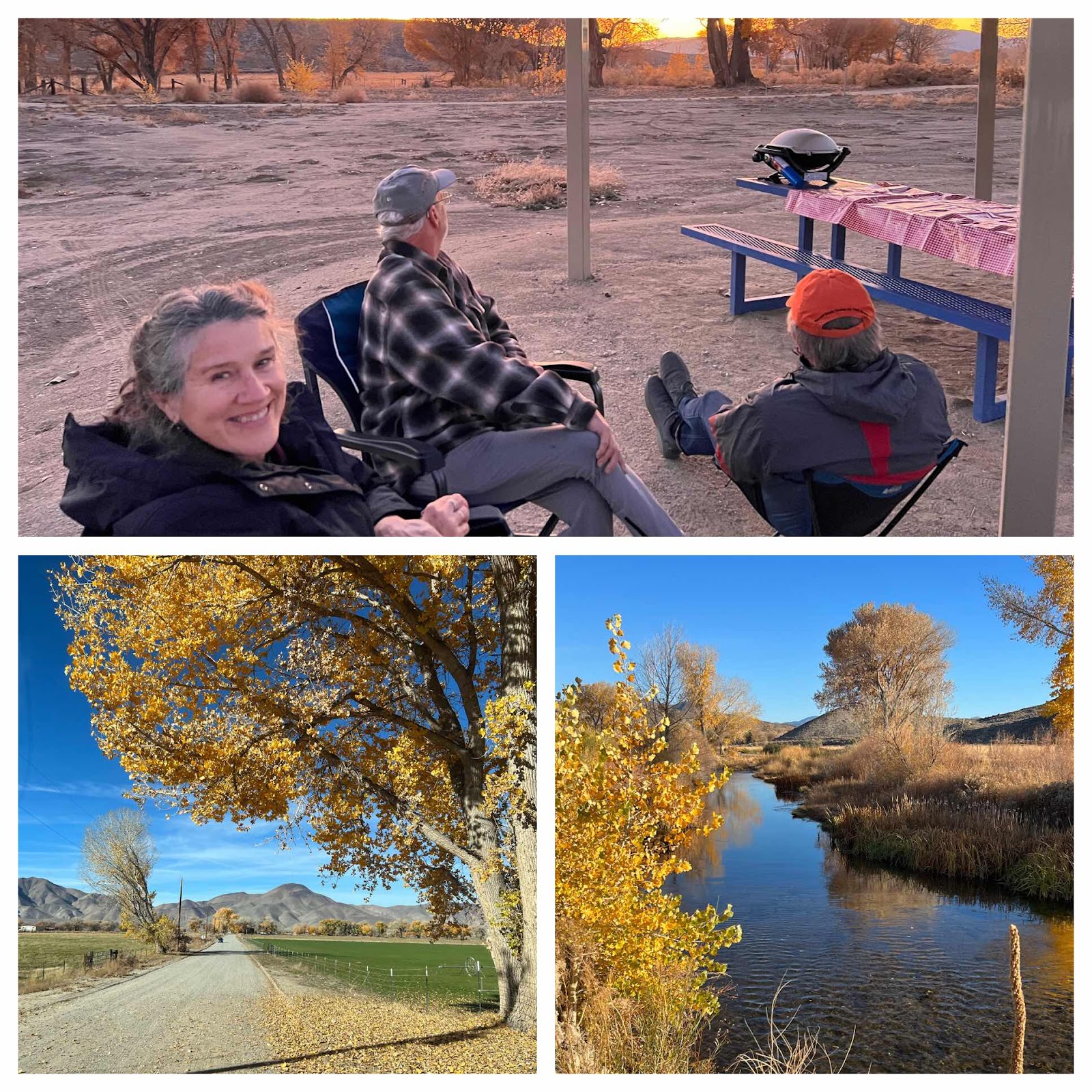
Eastern Sierras with Leila and Mike
Walker Ranch Recreation Area & Benton Hot Springs, We spent the last 4 days going off grid and exploring some unique areas around the hi...
-
 We woke up to sunny but cool weather in the Adirondack Mountains. You can definitely tell that we’re not in New England anymore, because ev...
 -
 When we woke up (rather late) this morning we were equally impressed with the blue skies and to find that we were camped near a sweet lit...
 -
 Location: Boysen State Park, WY Reluctantly leaving Custard State Park our first stop was Jewel Cave National Monument. As far as caves go...